| Identifier | M197WO | ||||||||
|---|---|---|---|---|---|---|---|---|---|
| Alternate names | M-1-97-WO,AR-5-97 | ||||||||
| Purpose | Collect geophysical data to aid in characterizing seismic hazard of nearshore faults & coastal erosion hazard | ||||||||
| Description | United States Geological Survey, Menlo Park, California. Chief Scientists: Pat McCrory, Dave Twichell. Geophysical data (GPS, sidescansonar, 3dot5khz, Geopulse, Shipekgrab, GPS, boomer) of field activity M-1-97-WO in Southwest Washington Inner Shelf from 07/07/1997 to 07/15/1997 | ||||||||
| Location | Southwest Washington Inner Shelf | ||||||||
| Summary | Collect approx 400 km of high resolution seismic reflection and sidescan sonar data | ||||||||
| Info derived | Seafloor character, late quaternary sediment thickness, shallow ( | ||||||||
| Comments | Staff information imported from InfoBank Pat McCrory (USGS Western Region) - Chief Scientist Dave Foster (USGS Western Region) - Computer Analyst Scott Harrison (USGS Western Region) - Computer Analyst Tom O'Brien (USGS Woods Hole) - Electronics Technician Jim Morris (NOAA) - Ship Captain | ||||||||
| Projects | |||||||||
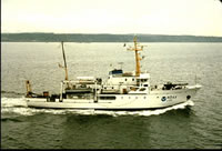
| Platform |
|
||||||||
| Itinerary |
|
||||||||
| Bounds |
|
||||||||
| Activity | Geophysical |
| Organization |
2885 Mission Street
Santa Cruz, CA95060
(831) 460-7401
|
||||
|---|---|---|---|---|---|
| Principal investigators | McCrory, Pat | ||||
| Crew members |
|
||||
| Information specialist(s) |
|
||||
| Affiliate principal | Dave Twichell | ||||
| Affiliate staff | Tom O'Brien (USGS Woods Hole) - Electronics Technician,Jim Morris (NOAA) - Ship Captain |
| Data category: | Location-Elevation, Sampling, Seismics, Sonar |
|---|---|
| Data type: | Navigation, Geology, Boomer, Sub Bottom Profiler, Sidescan |
| Equipment | Usage description | Data types | Datasets |
|---|---|---|---|
| GPS | Navigation | 5 | |
| 3.5khz | Sub Bottom Profiler | 3 | |
| Geopulse | Boomer | 3 | |
| Shipekgrab | Geology | 1 | |
| boomer | Boomer | (no data reported) | |
| sidescansonar | Sidescan | (no data reported) |
| Dataset name | Equipment | Description | Dataset contact |
|---|---|---|---|
| Best file with nav in ArcInfo E00 format | GPS | Mike Hamer | |
| Global positioning system (GPS) data m-1-97-wo.061 | GPS | Provisional best file | Mike Hamer |
| Global positioning system (GPS) data m-1-97-wo.061_degree | GPS | Mike Hamer | |
| Integrated navigation (SINS) data m-1-97-wo.051 | GPS | Mike Hamer | |
| Lines | GPS | Mike Hamer | |
| NGDC MGD77 data - bathy | 3.5khz | Carolyn Hayashida Degnan | |
| Raw depth (bathymetry) data m-1-97-wo.300 | 3.5khz | Mike Hamer | |
| Raw depth (bathymetry) data m-1-97-wo.300_061 | 3.5khz | Provisional best file | Mike Hamer |
| Raw seismic shot point data m-1-97-wo.400 | Geopulse | Mike Hamer | |
| Raw seismic shot point data m-1-97-wo.400_071 | Geopulse | Mike Hamer | |
| Seismic FFID/Shot/CDP data m-1-97-wo.410_061 | Geopulse | Mike Hamer | |
| Station Information | Shipekgrab | Mike Hamer |