Coop w/ NBS to determine the geological characteristics of the fjord floor where NBS has been studying crab and halibut distributions.
Description
Chief Scientist: Paul Carlson. Geological data (YoNav, mudseis, GPS, Kleinsidescan, 3dot5khz) of field activity Q-1-96-GB in Glacier Bay National Park from 08/02/1996 to 08/09/1996
Location
Glacier Bay National Park
Summary
Insonified fjord floor at 6 study sites in lower Glacier Bay (Bartlett Cove, Berg Bay, Sitakaday Narrows, submerged ridge between Drake and Francis Island, and 2 sites in the Beardsley Islands--1st north along Link Is., 2nd south near Eider Is.).
Info derived
Character of fjord floor -- morphologic, sedimentologic, stratigraphic, (depth to acoustic basement, isopachs of sedimentary units, location of bedrock outcrops and large glacial erratics, differentiating sand and mud substrates, identifying bedforms, etc).
Comments
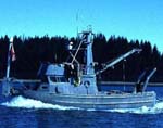
REPORT FROM ALASKA (from 8/30/96 WRUSGS Bulletin) Dave Hogg, John Gann, Terry Bruns, and Paul Carlson joined forces with our new siblings from National Biological Service (NBS) and our cousins from the Park Service for a productive 10-day (8/1-10) sidescan-sonar (SSS) survey in Glacier Bay, AK. We collected 500 kHz SSS + 3.5 kHz profiler data in five portions of Glacier Bay National Park. The areas insonified are Dungeness Crab and Halibut study sites. We will provide seafloor habitat interpretations that the biologists hope will explain distributions of those two commercial resources. We were fortunate to be able to sample some of the very tasty resources as well. In one study area, to the biologists glee, we obtained good imagery of a sunken skiff that the Skipper of the R/V Quillback identified as "Tommys boat," and we also saw a pile of Tommys crab pots a short distance away (overloading of pot + choppy seas = sinking). Bruns even saw the sun one day and realized his wish to see the eastern side of the Fairweather Range (beautiful view).
Staff information imported from InfoBank
Paul Carlson (USGS Western Region) - Chief Scientist
Terry Bruns (USGS Western Region) - Geophysicist
Jim Taggart (USGS BRD) - Biology Team Leader
Philip Hooge (USGS BRD) - Biologist
Dave Hogg (USGS Western Region) - Electrical Technician
John Gann (USGS Western Region) - Navigation
Jim De la Bruere (NPS) - Skipper