| Identifier | T174EG | ||||||||
|---|---|---|---|---|---|---|---|---|---|
| Alternate names | T-1-74-EG,EGAL-74-XA | ||||||||
| Description | Chief Scientist: Jim Grow. Data (navigation) of field activity T-1-74-EG in Northern Gulf of Alaska from 09/05/1974 to 09/11/1974 | ||||||||
| Location | Northern Gulf of Alaska | ||||||||
| Summary | Gravity, magnetics, 40 cubic-inch airgun, minisparkers, 3.5 khz transducer, seismic refraction line shots, accelerometer, side scan | ||||||||
| Comments | Staff information imported from InfoBank Jim Grow (USGS Woods Hole) - Chief Scientist Paul Passmore - Aquatr. | ||||||||
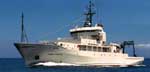
| Platform |
|
||||||||
| Itinerary |
|
||||||||
| Bounds |
|
| Organization |
2885 Mission Street
Santa Cruz, CA95060
(831) 460-7401
|
|---|---|
| Principal investigators | John Grow |
| Crew members | |
| Affiliate principal | Jim Grow (USGS Woods Hole) |
| Affiliate staff | Paul Passmore - Aquatr. |
| Data category: | Electro-Magnetic, Location-Elevation, Seismics, Sonar |
|---|---|
| Data type: | Gravity, Magnetics, Navigation, Air Gun / Water Gun, Sparker, Sub Bottom Profiler, Sidescan |
| Equipment | Usage description | Data types | Datasets |
|---|---|---|---|
| magnetics | Magnetics | (no data reported) | |
| gravity | Gravity | (no data reported) | |
| navigation | Navigation | 4 | |
| 3.5khz | Sub Bottom Profiler | (no data reported) | |
| sparker | Sparker | (no data reported) | |
| airgun | Air Gun / Water Gun | (no data reported) | |
| sidescansonar | Sidescan | (no data reported) |
| Dataset name | Equipment | Description | Dataset contact |
|---|---|---|---|
| Best file with nav in ArcInfo E00 format | navigation | Carolyn Hayashida Degnan | |
| Dead reckoning data t-1-74-eg.010 | navigation | Provisional best file | Carolyn Hayashida Degnan |
| Dead reckoning data t-1-74-eg.010_degree | navigation | Carolyn Hayashida Degnan | |
| Satellite data t-1-74-eg.000 | navigation | Carolyn Hayashida Degnan |