| Identifier | 94LCA01 | ||||||||
|---|---|---|---|---|---|---|---|---|---|
| Alternate names | P-1-94-FL | ||||||||
| Purpose | Characterize near-surface geology as it relates to sinkholes. | ||||||||
| Location | Orange Lake, Florida | ||||||||
| Summary | Boomer (9 lines). | ||||||||
| Info derived | Geophysical Data | ||||||||
| Comments | 94LCA01 FACS logs were generated by Karynna Calderon in October of 2003 using the handwritten logbook and personal accounts of the crew members. | ||||||||
| Projects | |||||||||
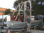
| Platform |
|
||||||||
| Itinerary |
|
||||||||
| Bounds |
|
| Organization | St. Johns River Water Management District(SJRWMD) |
||
|---|---|---|---|
| Organization |
600 Fourth Street South
St. Petersburg, FL33701-4846
(727) 502-8000
|
||
| Principal investigators | Jack L Kindinger | ||
| Crew members | |||
| Information specialist(s) |
|
| Data category: | Location-Elevation, Seismics |
|---|---|
| Data type: | Navigation, Boomer |
| Equipment | Usage description | Data types | Datasets |
|---|---|---|---|
| Global Positioning System (GPS) | Navigation | 2 | |
| Huntec ESU-PSU | Boomer, Sub Bottom Profiler | (no data reported) | |
| ITI ST-5 Hydrophone Streamer | Air Gun / Water Gun, Boomer, Sparker | 1 |
| Dataset name | Equipment | Description | Dataset contact |
|---|---|---|---|
| 500-Shot Interval Navigation | Global Positioning System (GPS) | Jack L Kindinger | |
| Edited Shotpoint Navigation | Global Positioning System (GPS) | Jack L Kindinger | |
| Boomer seismic data | ITI ST-5 Hydrophone Streamer | James G Flocks |