| Identifier | A284WF | ||||||||
|---|---|---|---|---|---|---|---|---|---|
| Alternate names | A-2-84-WF,Dive_1463 | ||||||||
| Description | United States Geological Survey, Menlo Park, California. Chief Scientist: Bill Normark. Geological and Geophysical data (chaindredge, pipedredge, 3dot5khz, underwatertelevision, underwatercamera, courserecorder, dopplersonar, LoranC, radar, transitsatellite) of field activity A-2-84-WF in Juan De Fuca from 09/15/1984 to 10/01/1984 | ||||||||
| Location | Juan De Fuca | ||||||||
| Summary | physical data holdings | ||||||||
| Comments | Staff information imported from InfoBank Bill Normark (USGS Western Region) - Chief Scientist Ellen Kappel (USGS Western Region) - Geologist Hank Chezar (USGS Western Region) - Oceanographer Jan Morton (USGS Western Region) - Geophysicist Jim Bischoff (USGS Western Region) - Geologist John Bizzozero - Chief Engineer John Slack (USGS Eastern Region) - Geologist Karen Von Damm - Geologist Kevin O'Toole (USGS Western Region) - Mechanical Technician Pat Shanks (USGS Eastern Region) - Geologist Randy Koski (USGS Western Region) - Geologist Reuben Baker Jr - Ship Captain Rob Zierenberg (USGS Western Region) - Geologist Robin Brett (USGS Western Region) - Geologist Robin Holcomb (USGS Western Region) - Geologist Roy Fields (USGS Western Region) - Electronics Technician Stephanie Ross (USGS Western Region) - Geophysicist William A Gillard Jr - Chief Mate | ||||||||
| Platform |
|
||||||||
| Itinerary |
|
||||||||
| Bounds |
|
||||||||
| Activity | Geological and Geophysical |
| Organization |
2885 Mission Street
Santa Cruz, CA95060
(831) 460-7401
|
||||||||||||||||||||||||||||||
|---|---|---|---|---|---|---|---|---|---|---|---|---|---|---|---|---|---|---|---|---|---|---|---|---|---|---|---|---|---|---|---|
| Principal investigators | Normark, Bill | ||||||||||||||||||||||||||||||
| Crew members |
|
||||||||||||||||||||||||||||||
| Affiliate staff | John Slack (USGS Eastern Region) - Geologist,Karen Von Damm - Geologist |
| Data category: | Imagery, Location-Elevation, Sampling, Seismics |
|---|---|
| Data type: | Photo, Video, Navigation, Geology, Sub Bottom Profiler |
| Equipment | Usage description | Data types | Datasets |
|---|---|---|---|
| pipedredge | Geology | (no data reported) | |
| chaindredge | Geology | 1 | |
| 3.5khz | Sub Bottom Profiler | 1 | |
| underwatertelevision | Video | 2 | |
| underwatercamera | Photo | (no data reported) | |
| courserecorder | Navigation | (no data reported) | |
| dopplersonar | Navigation | (no data reported) | |
| LoranC | Navigation | (no data reported) | |
| radar | Navigation | (no data reported) | |
| transitsatellite | Navigation | (no data reported) | |
| navigation | Navigation | 3 | |
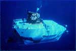
| submersible | Photo, Video, Biology, Geology | 1 |
| Dataset name | Equipment | Description | Dataset contact |
|---|---|---|---|
| chain dredge locations | chaindredge | Bill Normark | |
| bathy info | 3.5khz | Bill Normark | |
| underwater camera | underwatertelevision | Bill Normark | |
| underwater television | underwatertelevision | Bill Normark | |
| Eotvos/course/speed/distance data a-2-84-wf.070 | navigation | Bill Normark | |
| Eotvos/course/speed/distance data a-2-84-wf.071 | navigation | Provisional best file | Bill Normark |
| Satellite data a-2-84-wf.000 | navigation | Bill Normark | |
| ALV1457 | submersible | massive sulfide samples | Carol A Reiss |