| Identifier | B172GA | ||||||||
|---|---|---|---|---|---|---|---|---|---|
| Alternate names | B-1-72-GA,AGAL-72-XA | ||||||||
| Description | Geophysical data (3dot5khz, 12khz) of field activity B-1-72-GA in Gulf of Alaska from 01/01/1972 to 01/01/1972 | ||||||||
| Location | Gulf of Alaska | ||||||||
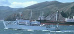
| Platform |
|
||||||||
| Itinerary |
|
||||||||
| Bounds |
|
||||||||
| Activity | Geophysical |
| Data category: | Location-Elevation, Seismics, Sonar |
|---|---|
| Data type: | Navigation, Sub Bottom Profiler, Single Beam |
| Equipment | Usage description | Data types | Datasets |
|---|---|---|---|
| 3.5khz | Sub Bottom Profiler | 1 | |
| 12khz | Single Beam | 1 | |
| seismic | Sub Bottom Profiler | (no data reported) | |
| navigation | Navigation | (no data reported) |
| Dataset name | Equipment | Description | Dataset contact |
|---|---|---|---|
| 35mm microfilm 54C and 54D: 3.5 khz bathymetry | 3.5khz | Analog Materials list | Carol A Reiss |
| 35mm microfilm 54A and 54B: 12 khz bathymetry | 12khz | Analog Materials list | Carol A Reiss |