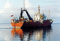
| Identifier | F188SC | ||||||||
|---|---|---|---|---|---|---|---|---|---|
| Alternate names | F-1-88-SC | ||||||||
| Description | Chief Scientists: Mike Field, Jim Gardner. Geological and Geophysical data (GPS, LoranC, RhoRho, Sonatracktransducer, transitsatellite, tempsalinometer, Gloriasidescan, pipedredge, boxcore, gravitycore, 10khz, 12khz, 3dot5khz, underwatercamera, underwatertelevision, expendablebatthermograph, bottomtransponder) of field activity F-1-88-SC in Southern California from 01/12/1988 to 01/19/1988 | ||||||||
| Location | Southern California | ||||||||
| Summary | physical data holdings | ||||||||
| Comments | Staff information imported from InfoBank Mike Field (USGS Western Region) - Chief Scientist Jim Gardner (USGS Western Region) - Chief Scientist | ||||||||
| Projects | |||||||||
| Platform |
|
||||||||
| Itinerary |
|
||||||||
| Bounds |
|
||||||||
| Activity | Geological and Geophysical |
| Principal investigators | Michael E FieldGardner, Jim |
|---|---|
| Crew members |
| Data category: | Environmental Data, Imagery, Location-Elevation, Sampling, Seismics, Sonar |
|---|---|
| Data type: | Conductivity, Temperature, Photo, Video, Navigation, Transects, Biology, Geology, Sub Bottom Profiler, Sidescan, Single Beam |
| Equipment | Usage description | Data types | Datasets |
|---|---|---|---|
| GPS | Navigation | 6 | |
| RhoRho | Navigation | 1 | |
| Sonatracktransducer | Single Beam | 1 | |
| transitsatellite | Navigation | 1 | |
| tempsalinometer | Conductivity, Temperature | (no data reported) | |
| Gloriasidescan | Sidescan | (no data reported) | |
| pipedredge | Geology | 1 | |
| boxcore | Chemistry, Biology, Geology | 1 | |
| gravitycore | Geology | 1 | |
| 10khz | Single Beam | 1 | |
| 12khz | Single Beam | 1 | |
| 3.5khz | Sub Bottom Profiler | 1 | |
| underwatercamera | Video, Photo | 1 | |
| underwatertelevision | Video | 2 | |
| expendablebatthermograph | Temperature | 1 | |
| bottomtransponder | Transects | 1 | |
| LoranC | Navigation | (no data reported) |