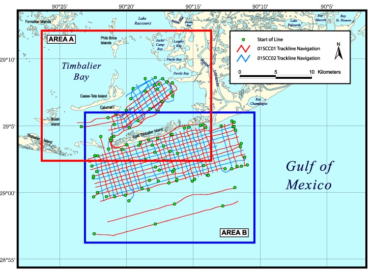
Trackline map of all chirp seismic reflection data collected during USGS Cruises 01SCC01 and 01SCC02. These data were collected in Timbalier Bay and in the Gulf of Mexico offshore of East Timbalier Island, Louisiana, in June, July, and August of 2001. This map is in geographic projection and was created at a scale of 1:200,000 using ESRI GIS software ArcView 3.2. The image was exported to Adobe Illustrator for further editing and saved for the web in JPEG format. The USGS is not the originator of all layers used in creating the maps presented in this archive. The rivers layer is a Louisiana Oil Spill Coordinator's Office (LOSCO) data set derived from ESRI/Geographic Data Technology, Inc. (GDT) data that were in turn derived from Bureau of the Census TIGER/Line files. The water bodies layer is also a LOSCO data set derived from ESRI/GDT data.
