| Description |
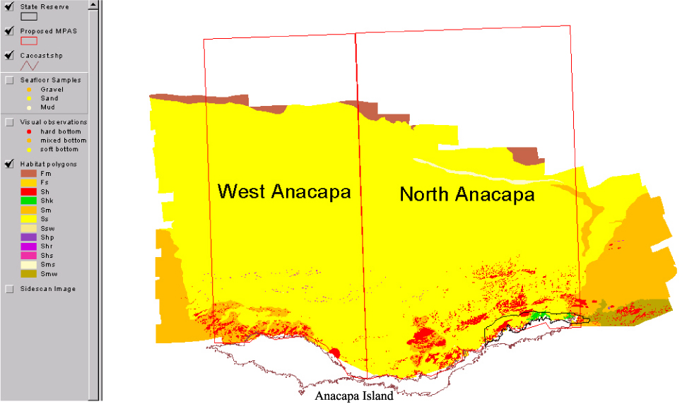
Benthic habitat polygon coverages have been created for marine reserve locations surrounding the Santa Barbara Basin. Diver, ROV and submersible video transects, bathymetry data, sedimentary samples, and sonar mapping, have been integrated to describe the geological, biological, and oceanographic aspects of habitat. Anacapa Reserve, is part of the Marine Ecological Reserves Research Program (MERRP). The U.S. Geological Survey (USGS), in a cooperative project with Sea Grant-MERRP and investigators at National Marine Fisheries Service (NMFS), the Channel Islands National Marine Sanctuary (CINMS), and National Park Service (NPS) has collected sidescan sonar and video data to produce a polygon coverage. The habitat polygons have attributes for megahabitat, bottom induration, macrohabitat (where macrohabitat observations are available), polygon area, polygon perimeter, and water depth. The habitat GIS shows rocky habitat suitable for rockfish (Sebastes sp.), abalone (Haliotis sp.), and other threatened benthic species from the shoreline out to the 100-m depth limit of the survey. [More]
|
