Online Links:
Online Links:
| Range of values | |
|---|---|
| Minimum: | 260 |
| Maximum: | 262 |
| Units: | Julian days |
| Resolution: | 1 |
| Range of values | |
|---|---|
| Minimum: | 2019 |
| Maximum: | 2019 |
| Units: | years |
| Resolution: | 1 |
| Range of values | |
|---|---|
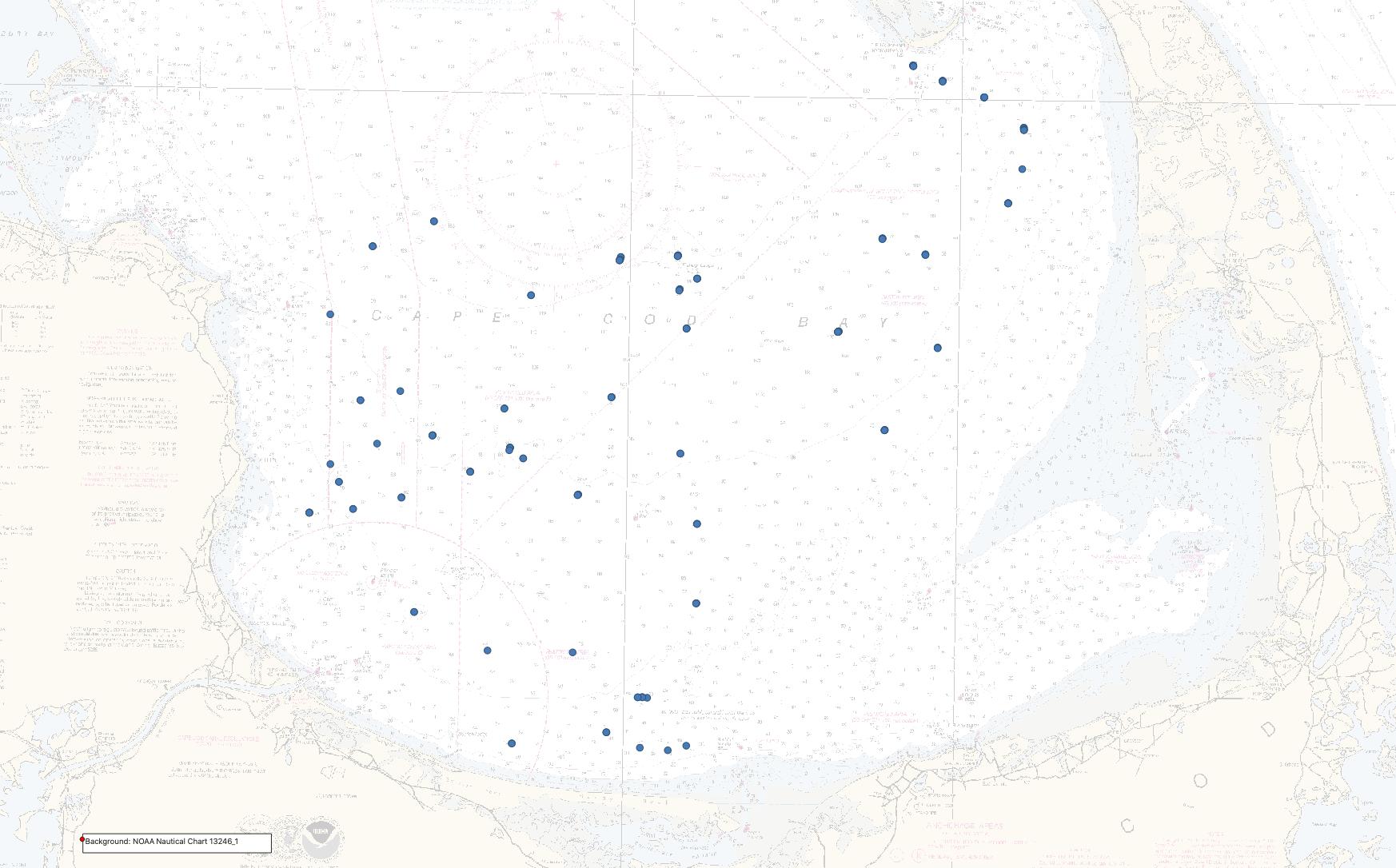
| Minimum: | 41.752888 |
| Maximum: | 42.012814 |
| Units: | decimal degrees |
| Resolution: | 0.000001 |
| Range of values | |
|---|---|
| Minimum: | -70.493223 |
| Maximum: | -70.135025 |
| Units: | decimal degrees |
| Resolution: | 0.000001 |
Online Links:
Online Links:
Online Links:
| Access_Constraints | None |
|---|---|
| Use_Constraints | Public domain data from the U.S. Government are freely redistributable with proper metadata and source attribution. Please recognize the U.S. Geological Survey as the originator of the dataset. |
| Data format: | This dataset contains a shapefile and CSV file of bottom image locations for photos of the sea floor collected by the U.S. Geological Survey in Cape Cod Bay, Massachusetts, in September 2019. The transfer size of the data in a zip file is 15 KB. in format Shapefile (version Esri ArcGIS Pro 2.4.1) Shapefile Size: 315 |
|---|---|
| Network links: |
https://cmgds.marine.usgs.gov/data-releases/media/2021/10.5066-P99DR4PN/cfd4e28a4781409084c4e17034d612a3/2019-034-FA_photolocations.zip https://cmgds.marine.usgs.gov/data-releases/datarelease/10.5066-P99DR4PN/ https://doi.org/10.5066/P99DR4PN |
| Data format: | This dataset contains a shapefile and CSV file of bottom image locations for photos of the sea floor collected by the U.S. Geological Survey in Cape Cod Bay, Massachusetts, in September 2019. The transfer size of the data in a zip file is 15 KB. in format Comma-delimited text (version Microsoft Excel 2016 for Mac) Comma Separated Values (CSV) text file Size: 0.15 |
|---|---|
| Network links: |
https://cmgds.marine.usgs.gov/data-releases/media/2021/10.5066-P99DR4PN/cfd4e28a4781409084c4e17034d612a3/2019-034-FA_photolocations.zip https://cmgds.marine.usgs.gov/data-releases/datarelease/10.5066-P99DR4PN/ https://doi.org/10.5066/P99DR4PN |
| Data format: | This dataset contains geotagged JPEG images of the sea floor collected by the U.S. Geological Survey in Cape Cod Bay, Massachusetts, in September 2019. The images can be downloaded or viewed using USGS Coastal and Marine Hazards and Resources Program's Imagery Data System. The total file size for downloading all images is approximately 315 MB. in format JPEG Size: 315 |
|---|---|
| Network links: |
https://cmgds.marine.usgs.gov/idsviewer/data_release/10.5066-P99DR4PN https://cmgds.marine.usgs.gov/data-releases/datarelease/10.5066-P99DR4PN/ https://doi.org/10.5066/P99DR4PN |