JPEG images of bottom samples collected by the U.S. Geological Survey in Moultonborough Bay, Lake Winnipesaukee, New Hampshire in 2005 (JPEG Images)

Metadata also available as - [Questions & Answers] - [Parseable text] - [XML]

Metadata:

Identification_Information:
Citation:
Citation_Information:
Originator: U.S. Geological Survey
Publication_Date: 2014
Title:
JPEG images of bottom samples collected by the U.S. Geological Survey in Moultonborough Bay, Lake Winnipesaukee, New Hampshire in 2005 (JPEG Images)
Edition: 1.0
Geospatial_Data_Presentation_Form: raster digital data
Series_Information:
Series_Name: data release
Issue_Identification: DOI:10.5066/F71N7Z4H
Publication_Information:
Publication_Place:
Woods Hole Coastal and Marine Science Center, Woods Hole, Massachusetts
Publisher: U.S. Geological Survey, Coastal and Marine Geology Program
Online_Linkage: https://doi.org/10.5066/F71N7Z4H
Online_Linkage: Online_Linkage: Larger_Work_Citation:
Citation_Information:
Originator: Denny, J.F.
Originator: Danforth, W.W.
Originator: Worley, C.R.
Originator: Irwin, B.J.
Publication_Date: 2014
Title:
High-resolution geophysical and sample data collected in Moultonborough Bay, Lake Winnipesaukee, New Hampshire in 2005, USGS Field Activity 2005-004-FA
Edition: 1.0
Series_Information:
Series_Name: data release
Issue_Identification: DOI:10.5066/F71N7Z4H
Publication_Information:
Publication_Place: Reston, VA
Publisher: U.S. Geological Survey
Online_Linkage: https://doi.org/10.5066/F71N7Z4H
Description:
Abstract:
In freshwater bodies of New Hampshire, the most problematic aquatic invasive plant species is Myriophyllum heterophyllum or variable leaf water-milfoil. Once established, variable leaf water-milfoil forms dense beds that can alter the limnologic characteristics of a waterbody, impacting natural lacustrine communities and their habitats. Variable leaf water-milfoil infestations also disrupt recreational uses of waterbodies and have negatively affected swimming, boating, fishing, and property values in and around several lakes and ponds in New Hampshire.
In 1965, Moultonborough Bay, Lake Winnipesaukee became the first waterbody in New Hampshire where variable leaf water-milfoil was observed. Variable leaf water-milfoil is native to the Southeastern and Midwestern areas of the United States where more alkaline waters appear to limit the growth of this plant. Outside its native range, however, it adapts well to the relatively acidic, low-alkalinity, and nutrient-poor conditions of oligotrophic lakes and bays similar to Moultonborough Bay.
In 2005, the New Hampshire Department of Environmental Services (NHDES) collaborated with the U.S. Geological Survey to investigate the distribution (presence and density) of variable leaf water-milfoil in Moultonborough Bay. This study utilized geophysical systems and conventional water-quality measurements to identify lake-floor environments that may provide suitable habitat for the establishment and growth of variable leaf water-milfoil. The results of the study are intended to assist resource managers in federal and state agencies by providing methods for detecting variable leaf water-milfoil and for identifying areas susceptible to infestation. Ultimately, this information may lead to early detection, prevention, and more effective mitigation strategies.
Field activity information for this cruise is available on-line through the U.S. Geological Survey Coastal and Marine Geoscience Data System https://cmgds.marine.usgs.gov/fan_info.php?fa=2005-004-FA.
Purpose:
This data set includes the bottom photographs (JPEG images) collected within Moultonborough Bay, Lake Winnipesaukee, New Hampshire during USGS field activity 2005-004-FA. The bottom photographs were collected to ground-truth the geophysical data collected and used to characterize the surficial sediment and bottom habitat of the lakefloor.
Time_Period_of_Content:
Time_Period_Information:
Range_of_Dates/Times:
Beginning_Date: 20050727
Ending_Date: 20050728
Currentness_Reference: ground condition
Status:
Progress: Complete
Maintenance_and_Update_Frequency: None planned
Spatial_Domain:
Bounding_Coordinates:
West_Bounding_Coordinate: -71.390840
East_Bounding_Coordinate: -71.359890
North_Bounding_Coordinate: 43.728250
South_Bounding_Coordinate: 43.712080
Keywords:
Theme:
Theme_Keyword_Thesaurus: USGS Metadata Identifier
Theme_Keyword: USGS:e3afb2a7-bb52-4ade-9170-93e3016e8df3
Theme:
Theme_Keyword_Thesaurus: None
Theme_Keyword: U.S. Geological Survey
Theme_Keyword: USGS
Theme_Keyword: Coastal and Marine Geology Program
Theme_Keyword: CMGP
Theme_Keyword: Woods Hole Coastal and Marine Science Center
Theme_Keyword: WHCMSC
Theme_Keyword: Marine Geology
Theme_Keyword: field activity number 2005-004-FA
Theme_Keyword: USGS CMGP InfoBank ID R-1-05-NH
Theme_Keyword: field activity number 05004
Theme_Keyword: SEABOSS
Theme_Keyword: SEABed Observation and Sampling System
Theme_Keyword: bottom photographs
Theme_Keyword: JPEG
Theme_Keyword: R/V Rafael
Theme:
Theme_Keyword_Thesaurus: ISO 19115 Topic Category
Theme_Keyword: inlandWaters
Theme_Keyword: location
Theme_Keyword: geoscientificInformation
Theme:
Theme_Keyword_Thesaurus: USGS Thesaurus
Theme_Keyword: image collections
Theme_Keyword: underwater photography
Theme_Keyword: lakebed characteristics
Place:
Place_Keyword_Thesaurus: None
Place_Keyword: North America
Place_Keyword: United States
Place_Keyword: New Hampshire
Place_Keyword: Lake Winnipesaukee
Place_Keyword: Moultonborough Bay
Access_Constraints: None.
Use_Constraints:
Public domain data from the U.S. Government are freely redistributable with proper metadata and source attribution. Please recognize the U.S. Geological Survey as the originator of the dataset.
Point_of_Contact:
Contact_Information:
Contact_Person_Primary:
Contact_Person: Jane F. Denny
Contact_Organization: U.S. Geological Survey
Contact_Position: Geologist
Contact_Address:
Address_Type: mailing and physical address
Address: 384 Woods Hole Road
City: Woods Hole
State_or_Province: Massachusetts
Postal_Code: 02543
Country: USA
Contact_Voice_Telephone: 508-548-8700 x 2311
Contact_Facsimile_Telephone: 508-457-2310
Contact_Electronic_Mail_Address: jdenny@usgs.gov
Browse_Graphic:
Browse_Graphic_File_Name: Browse_Graphic_File_Description:
Thumbnail image of a bottom photograph collected by the U.S. Geological Survey in Moultonborough Bay, Lake Winnipesaukee, New Hampshire, 2005
Browse_Graphic_File_Type: JPEG
Native_Data_Set_Environment:
Microsoft Windows Vista Version 6.1 (Build 7601) Service Pack 1; ESRI ArcCatalog 9.3.1.1850
Cross_Reference:
Citation_Information:
Originator: Denise M. Argue
Originator: Richard G. Kiah
Originator: Jane F. Denny
Originator: Jeffrey R. Deacon
Originator: William W. Danforth
Originator: Craig M. Johnston
Originator: Amy P. Smagula
Publication_Date: 2007
Title:
Relation of Lake-Floor Characteristics to the Distribution of Variable Leaf Water-Milfoil in Moultonborough Bay, Lake Winnipesaukee, New Hampshire, 2005
Edition: 1.0
Geospatial_Data_Presentation_Form: document
Series_Information:
Series_Name: Scientific Investigations Report
Issue_Identification: 2007-5125
Publication_Information:
Publication_Place: Reston, Virginia
Publisher: U.S. Geological Survey
Online_Linkage: https://pubs.usgs.gov/sir/2007/5125/
Cross_Reference:
Citation_Information:
Originator: D. Blackwood
Originator: K. Parolski
Publication_Date: 2001
Title: Seabed observation and sampling system
Edition: 1.0
Geospatial_Data_Presentation_Form: document
Series_Information:
Series_Name: Sea Technology
Issue_Identification: v. 42, no. 2, p. 39-43
Publication_Information:
Publication_Place: Arlington, Virginia
Publisher: Sea Technology
Data_Quality_Information:
Logical_Consistency_Report:
All bottom photographs were collected with the mini-SEABOSS (SEABed Observation and Sampling System) by the U.S. Geological Survey within the Moultonborough Bay, Lake Winnipesaukee, New Hampshire, 2005. Blackwood and Parolski, 2001
Completeness_Report:
Forty sample locations were occupied, however bottom photographs were not collected at sample locations 1, 2, 7B and 20 due to equipment problems. The digital camera, at these locations, was not operating properly and we were not able to successfully image the lakefloor with a digital image.
Positional_Accuracy:
Horizontal_Positional_Accuracy:
Horizontal_Positional_Accuracy_Report:
Navigation was acquired with Wide Area Augmentation System ( WAAS), which is accurate to + or - 1 to 2 meters, horizontally. Navigation data were acquired with a Communications Systems International (CSI), Inc. LGBX Pro receiver. The CSI LGBX Pro received positions from a WAAS antenna located on the port, aft roof of the R/V Rafael cabin. WAAS positions were recorded within HYPACK (www.hypack.com) navigation software. Offsets between the DGPS antenna and the mini-SEABOSS were not measured. The horizontal position of the mini-SEABOSS during sample collection is assumed to be +/- 10 meters at best, due to a lack of precise positional data at the time of sample recovery.
Lineage:
Source_Information:
Source_Citation:
Citation_Information:
Originator: U.S. Geological Survey
Publication_Date: Unpublished Material
Title: Sediment Textural Data
Type_of_Source_Media: online
Source_Time_Period_of_Content:
Time_Period_Information:
Range_of_Dates/Times:
Beginning_Date: 20050727
Ending_Date: 20050728
Source_Currentness_Reference: ground condition of field activity
Source_Citation_Abbreviation: none
Source_Contribution:
The Mini SEABOSS was designed specifically for the USGS Woods Hole Science Center's 26-foot research vessel Rafael. This system is equipped with two video cameras, a digital still camera, and a Van Veen grab sampler. This system, weighing approximately 200 lbs., can be used to depths up to 40 meters. The grab itself is raised and lowered with a 3/16-inch Aramid fiber winch-line with a breaking strength of 5,600 pounds. The davit is secured when the Mini SEABOSS is in the water. The electrical cable is on a spring-wound take-up reel with electrical slip rings that is mounted aft of the sampler. This arrangement protects the 0.38-in. multi-conductor cable and keeps the Mini SEABOSS correctly oriented with the boat. This multi-conductor cable enables communication between the ship's lab and the Mini SEABOSS system. The digital camera, a Minolta Dimage 7Hi, is mounted in a machined Delrin housing with a flat port and is set for 2560 x 1920 pixel images at the "fine" setting for compression. This allows the camera to be used for over 200 images with a 1 GB Compact Flash card without downloading. The system also has a 50 Watt/second flash unit powered by 8 AA batteries. Two battery-powered lasers are set 15 cm apart for scale measurements. The red laser dots can usually be seen in the photo depending on the bottom type and the distance to the sea floor. A third battery powered laser is positioned at an angle so that when it intersects the other lasers, the Mini SEABOSS is at the optimum height off the bottom for a still photograph (optimal height is generally 75 cm above the bottom). The camera is set to a manual focus and set to a default focus distance (50 cm) once the camera is powered up. The default focus distance is slightly less than the optimum height above the seafloor to account for optical distortion under water.
Video images were collected at 40 sample locations and digital photographs were collected at 35 sample locations using the USGS Mini SEABOSS (Blackwood and Parolski, 2001). Mini SEABOSS stations were selected based on preliminary acoustic-backscatter mosaics, with the objective of characterizing broad areas of different backscatter intensity. With the Mini SEABOSS deployed, the research vessel was allowed to drift with occasional power from the vessel to control drift direction. Continuous video was collected over a total of 696 meters of lakefloor. Video drift position was derived from the HYPACK navigation files based on the start and end times of the drift. For some portions of the drift, there was no navigation, so the position was derived from the time and position stamp in the video at 30-s intervals. Latitude and Longitude for sample locations 1 and 8 were derived solely from the video as HYPACK was not recording.
Process_Step:
Process_Description:
Bottom photographs were collected with the mini SEABOSS (Blackwood and Parolski, 2001) at 35 sample stations in Moultonborough Bay, Lake Winnipesaukee, New Hampshire, 2005.
This and all subsequent processing steps (unless otherwise noted) were conducted by Jane F. Denny.
Process_Date: 2005
Process_Contact:
Contact_Information:
Contact_Person_Primary:
Contact_Person: Jane F. Denny
Contact_Organization: U.S. Geological Survey
Contact_Position: Geologist
Contact_Address:
Address_Type: mailing and physical address
Address: 384 Woods Hole Road
City: Woods Hole
State_or_Province: Massachusetts
Postal_Code: 02543
Country: USA
Contact_Voice_Telephone: 508-548-8700 x2311
Contact_Facsimile_Telephone: 508-457-2310
Contact_Electronic_Mail_Address: jdenny@usgs.gov
Process_Step:
Process_Description:
The digital images were recorded on a compact flash card within the camera. Digital images were downloaded to a local disk and stored with a naming convention based on the station location. For example, sta11.jpg, is a bottom photograph collected at station (i.e. sample location) 11. Generally, only one bottom photograph was collected at each sample location.
Process_Date: 2005
Process_Step:
Process_Description:
The photo locations (2005-004-FA_photos.shp - see metadata for how the file was created on https://cmgds.marine.usgs.gov/data/field-activity-data/2005-004-FA/) were exported from ArcMap 9.3.1 using XTools Pro 7.1 as a comma-delimited text file. The attributes chosen for export were: LONG, LAT, YEAR, PICNAME, GPSTIME. The text editor VI v 7.3 was used to edit the year to include the calendar day in the format YYYYMMDD appropriate for the particular image. A PYTHON script (jane_write_exif.py) was then run that incorporated this information, along with additional information, into the appropriate locations in the EXIF header of each JPEG images. The PYTHON script uses exiftool (version 8.4.7.0) to write the information to the image headers.
The following tags were populated in the JPEG image headers. Information is duplicated in some tags. This was done because different software packages access different tags.
GPS tags: The values populated are unique for each image and based on the information exported from the photo locations shapefile.
GPSLatitudeRef
GPSLatitude
GPSLongitudeRef
GPSLongitude
GPSTimeStamp
GSPDateStamp
JPEG tags: The tag is listed along with the information used to populate it - which is the same for every image.
Comment: Photo from down-looking camera on the USGS SEABOSS deployed from the R/V Rafael
during survey 2005-004-FA (http://woodshole.er.usgs.gov/operations/ia/public_ds_info.php?fa=2005-004-FA)

EXIF tags: The tag is listed along with the information used to populate it - which is the same for every image.
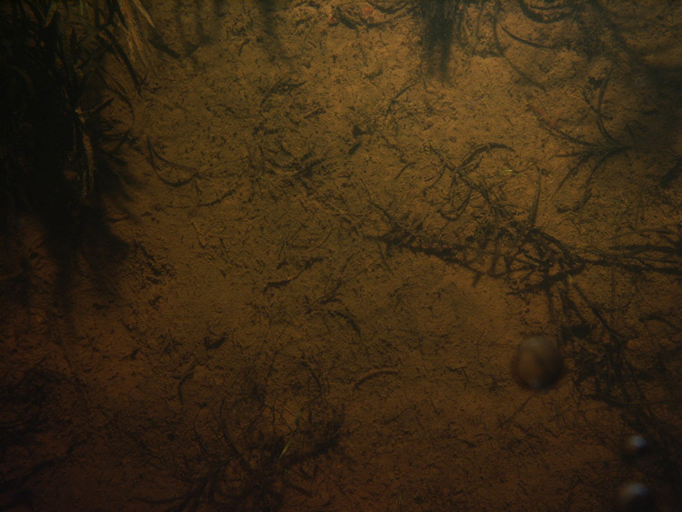
ImageDescription: Photograph of the lake floor in Lake Winnipesaukee, New Hampshire from survey 2005-004-FA
Artist: Jane Denny
Copyright: Public Domain - please credit U.S. Geological Survey


IPTC tags: The tag is listed along with the information used to populate it - which is the same for every image.
Credit: U.S. Geological Survey
Contact: WHSC_data_contact@usgs.gov
Keywords: Lake Winnipesaukee, New Hampshire, 2005-004-FA, SEABOSS, lake floor, USGS
CopyrightNotice: Public Domain - please credit U.S. Geological Survey
Caption-Abstract: Photograph of the lake floor in Lake Winnipesaukee, New Hampshire from survey 2005-004-FA


XMP tags: The tag is listed along with the information used to populate it - which is the same for every image.
Caption: Photograph of the lake floor in Lake Winnipesaukee, New Hampshire from survey 2005-004-FA.
Process_Date: 2014
Process_Contact:
Contact_Information:
Contact_Person_Primary:
Contact_Person: VeeAnn A. Cross
Contact_Organization: U.S. Geological Survey
Contact_Position: Marine Geologist
Contact_Address:
Address_Type: mailing and physical address
Address: 384 Woods Hole Road
City: Woods Hole
State_or_Province: Massachusetts
Postal_Code: 02543
Country: USA
Contact_Voice_Telephone: 508-548-8700x2251
Contact_Facsimile_Telephone: 508-457-2310
Contact_Electronic_Mail_Address: vatnipp@usgs.gov
Process_Step:
Process_Description:
The online links to the data were updated to reflect the new server hosting the data. Additionally, other small edits could be made to the metadata, such as modifying http to https where appropriate. The metadata date (but not the metadata creator) was edited to reflect the date of these changes.
Process_Date: 20170406
Process_Contact:
Contact_Information:
Contact_Organization_Primary:
Contact_Organization: U.S. Geological Survey
Contact_Person: VeeAnn A. Cross
Contact_Position: Marine Geologist
Contact_Address:
Address_Type: Mailing and Physical
Address: 384 Woods Hole Road
City: Woods Hole
State_or_Province: MA
Postal_Code: 02543-1598
Contact_Voice_Telephone: 508-548-8700 x2251
Contact_Facsimile_Telephone: 508-457-2310
Contact_Electronic_Mail_Address: vatnipp@usgs.gov
Process_Step:
Process_Description: USGS Thesaurus keywords added to the keyword section.
Process_Date: 20180720
Process_Contact:
Contact_Information:
Contact_Organization_Primary:
Contact_Organization: U.S. Geological Survey
Contact_Person: VeeAnn A. Cross
Contact_Position: Marine Geologist
Contact_Address:
Address_Type: Mailing and Physical
Address: 384 Woods Hole Road
City: Woods Hole
State_or_Province: MA
Postal_Code: 02543-1598
Contact_Voice_Telephone: 508-548-8700 x2251
Contact_Facsimile_Telephone: 508-457-2310
Contact_Electronic_Mail_Address: vatnipp@usgs.gov
Process_Step:
Process_Description:
Added keywords section with USGS persistent identifier as theme keyword.
Process_Date: 20200908
Process_Contact:
Contact_Information:
Contact_Organization_Primary:
Contact_Organization: U.S. Geological Survey
Contact_Person: VeeAnn A. Cross
Contact_Position: Marine Geologist
Contact_Address:
Address_Type: Mailing and Physical
Address: 384 Woods Hole Road
City: Woods Hole
State_or_Province: MA
Postal_Code: 02543-1598
Contact_Voice_Telephone: 508-548-8700 x2251
Contact_Facsimile_Telephone: 508-457-2310
Contact_Electronic_Mail_Address: vatnipp@usgs.gov
Spatial_Data_Organization_Information:
Direct_Spatial_Reference_Method: Raster
Distribution_Information:
Distributor:
Contact_Information:
Contact_Person_Primary:
Contact_Person: Jane F. Denny
Contact_Organization: U.S. Geological Survey
Contact_Position: Geologist
Contact_Address:
Address_Type: mailing and physical address
Address: 384 Woods Hole Road
City: Woods Hole
State_or_Province: Massachusetts
Postal_Code: 02543
Country: USA
Contact_Voice_Telephone: 508-548-8700 x2311
Contact_Facsimile_Telephone: 508-457-2310
Contact_Electronic_Mail_Address: jdenny@usgs.gov
Resource_Description:
The file 2005-004-FA_bottomphotos.zip contains the JPEG images of the sea floor bottom photographs. In addition to the bottom photographs, the zip file also contains the browse graphic (2005-004-FA_photosm.jpg) and the FGDC CSDGM metadata in the following formats: XML, HTML, FAQ and text.
Distribution_Liability:
Neither the U.S. Government, the Department of the Interior, nor the USGS, nor any of their employees, contractors, or subcontractors, make any warranty, express or implied, nor assume any legal liability or responsibility for the accuracy, completeness, or usefulness of any information, apparatus, product, or process disclosed, nor represent that its use would not infringe on privately owned rights. The act of distribution shall not constitute any such warranty, and no responsibility is assumed by the USGS in the use of these data or related materials. Any use of trade, product, or firm names is for descriptive purposes only and does not imply endorsement by the U.S. Government.
Standard_Order_Process:
Digital_Form:
Digital_Transfer_Information:
Format_Name: JPEG
Format_Version_Number: 1.0
Format_Specification: JPEG File Format
Format_Information_Content:
Zip file containing bottom photographs collected by the U.S. Geological Survey in Moultonborough Bay, Lake Winnipesaukee, New Hampshire survey area. This also includes associated metadata.
File_Decompression_Technique: Use WinZip, 7zip, Peazip or pkUnzip
Transfer_Size: 75
Digital_Transfer_Option:
Online_Option:
Computer_Contact_Information: Access_Instructions: Data can be downloaded via the World Wide Web (WWW)
Fees: none
Technical_Prerequisites:
This zip file contains data available in JPEG format. The zip file also contains associated metadata.
Metadata_Reference_Information:
Metadata_Date: 20200908
Metadata_Contact:
Contact_Information:
Contact_Person_Primary:
Contact_Person: Jane F. Denny
Contact_Organization: U.S. Geological Survey
Contact_Position: Geologist
Contact_Address:
Address_Type: mailing and physical address
Address: 384 Woods Hole Road
City: Woods Hole
State_or_Province: Massachusetts
Postal_Code: 02543
Country: USA
Contact_Voice_Telephone: 508-548-8700 x2311
Contact_Facsimile_Telephone: 508-457-2310
Contact_Electronic_Mail_Address: jdenny@usgs.gov
Metadata_Standard_Name: FGDC Content Standards for Digital Geospatial Metadata
Metadata_Standard_Version: FGDC-STD-001-1998
Metadata_Time_Convention: local time

This page is <https://cmgds.marine.usgs.gov/catalog/whcmsc/field_activities/2005_004_fa/2005-004-FA_photoJPGmeta.html>
Generated by mp version 2.9.50 on Tue Sep 21 18:20:14 2021