High-resolution geophysical and sample data collected in Moultonborough Bay, Lake Winnipesaukee, New Hampshire in 2005, U.S. Geological Survey Field Activity 2005-004-FA
| Field activity number | 2005-004-FA |
|---|---|
| Version | 1 |
| Area of operation | Moultonborough Bay, Lake Winnipesaukee, New Hampshire |
| Dates | 2005 |
| Chief scientist | Jane Denny |
Suggested citation: Denny, J. F, Danforth, W.W., Worley, C.R., and Irwin, B.J., 2014, High-resolution geophysical and sample data collected in Moultonborough Bay, Lake Winnipesaukee, New Hampshire in 2005, USGS Field Activity 2005-004-FA: U.S. Geological Survey data release, https://doi.org/10.5066/F71N7Z4H
Abstract: In freshwater bodies of New Hampshire, the most problematic aquatic invasive plant species is Myriophyllum heterophyllum or variable leaf water-milfoil. Once established, variable leaf water-milfoil forms dense beds that can alter the limnologic characteristics of a waterbody, impacting natural lacustrine communities and their habitats. Variable leaf water-milfoil infestations also disrupt recreational uses of waterbodies and have negatively affected swimming, boating, fishing, and property values in and around several lakes and ponds in New Hampshire. In 1965, Moultonborough Bay, Lake Winnipesaukee became the first waterbody in New Hampshire where variable leaf water-milfoil was observed. Variable leaf water-milfoil is native to the Southeastern and Midwestern areas of the United States where more alkaline waters appear to limit the growth of this plant. Outside its native range, however, it adapts well to the relatively acidic, low-alkalinity, and nutrient-poor conditions of oligotrophic lakes and bays similar to Moultonborough Bay. In 2005, the New Hampshire Department of Environmental Services (NHDES) collaborated with the U.S. Geological Survey to investigate the distribution (presence and density) of variable leaf water-milfoil in Moultonborough Bay. This study utilized geophysical systems and conventional water-quality measurements to identify lake-floor environments that may provide suitable habitat for the establishment and growth of variable leaf water-milfoil. The results of the study are intended to assist resource managers in federal and state agencies by providing methods for detecting variable leaf water-milfoil and for identifying areas susceptible to infestation. Ultimately, this information may lead to early detection, prevention, and more effective mitigation strategies . Field activity information for this cruise is available on-line through the U.S. Geological Survey Coastal and Marine Geoscience Data System https://cmgds.marine.usgs.gov/fan_info.php?fa=2005-004-FA.
Filename and description |
Download |
||
|---|---|---|---|
2005-004-FA_DATA |
2005-004-FA_DATA.zip |
||
Filename and description |
Preview |
Metadata |
Download |
Bathymetry |
|||
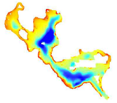
| winni_bathy 1-meter swath bathymetric grid collected by the USGS in Moultonborough Bay, Lake Winnipesaukee, New Hampshire in 2005 (UTM Zone 19N, WGS 84, Esri Binary Grid file format) |
 |
HTML FAQ TEXT XML |
winni_bathy.zip 2.79 MB |
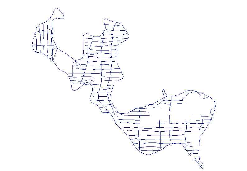
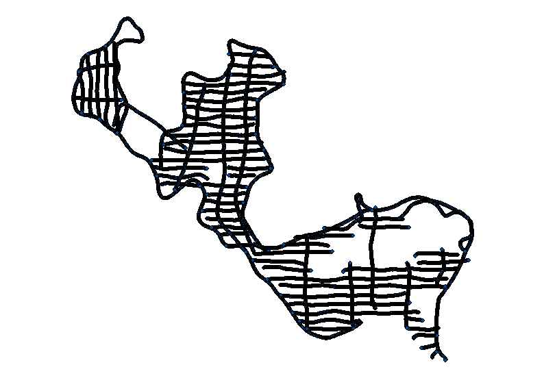
| 2005-004-FA_bathytrk Survey tracklines of swath bathymetry collected by the USGS in Moultonbourough Bay, Lake Winnipesaukee, New Hampshire in 2005 (Geographic, WGS 84, Esri polyline shapefile and CSV file formats) |
 |
HTML FAQ TEXT XML |
2005-004-FA_bathytrk.zip 93 KB |
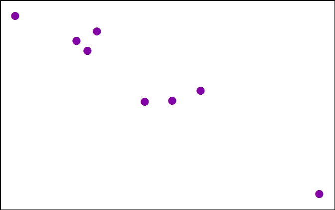
| 2005-004-FA_svp Sound velocity profile locations collected by the USGS in Moultonborough Bay, Lake Winnipesaukee, New Hampshire in 2005 (Geographic, WGS 84, Esri point shapefile, CSV file and JPEG image formats) |
 |
HTML FAQ TEXT XML |
2005-004-FA_svp.zip 954 KB |
Photographs |
|||
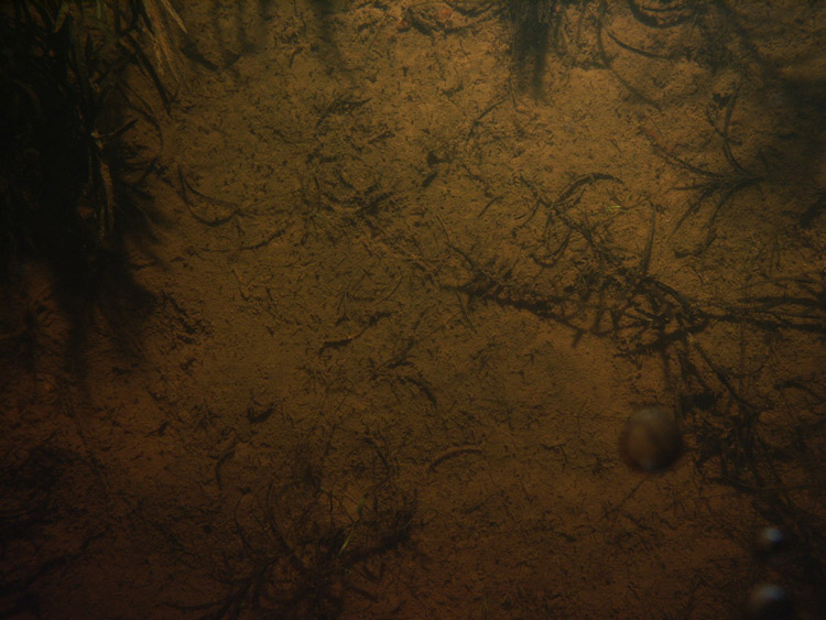
| 2005-004-FA_bottomphotos Images of bottom photographs collected by the USGS in Moultonborough Bay, New Hampshire in 2005 (JPEG image file formats. EXIF headers have been modified to include navigation and other meta tags) |
 |
HTML FAQ TEXT XML |
2005-004-FA_bottomphotos.zip 75.53 MB |
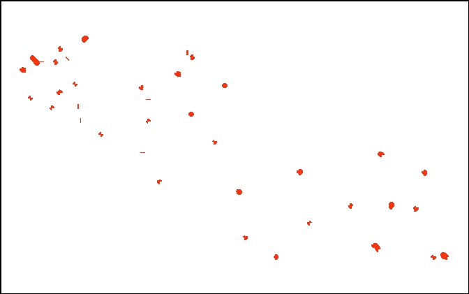
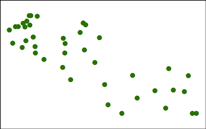
| 2005-004-FA_photolocs Locations of bottom photographs collected by the USGS in Moultonborough Bay, New Hampshire in 2005 (Geographic, WGS 84, Esri point shapefile) |
 |
HTML FAQ TEXT XML |
2005-004-FA_photolocs.zip 86 KB |
Seismics |
|||
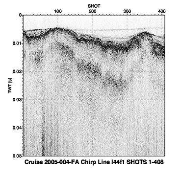
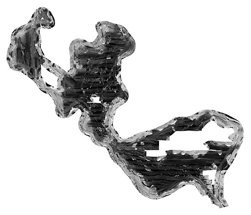
| 2005-004-FA_chimages Images of chirp subbottom profiler data collected by the USGS in Moultonborough Bay, Lake Winnipesaukee, New Hampshire in 2005 (JPEG image format. EXIF headers have been modified to include navigation and other meta tags) |
 |
HTML FAQ TEXT XML |
2005-004-FA_chimages.zip 24.60 MB |
| 2005-004-FA_chirpsht Unique shot point navigation for Edgetech SB-424 chirp subbottom profiler data collected by the USGS in Moultonborough Bay, Lake Winnipesaukee, New Hampshire in 2005 (Geographic, WGS 84, Esri point shapefile and CSV file formats) |
 |
HTML FAQ TEXT XML |
2005-004-FA_chirpsht.zip 732 KB |
| 2005-004-FA_chirptrk Survey tracklines of chirp subbottom data collected by the USGS in Moultonborough Bay, Lake Winnipesaukee, New Hampshire in 2005 (Geographic, WGS 84, Esri polyline shapefile file format) |
 |
HTML FAQ TEXT XML |
2005-004-FA_chirptrk.zip 217 KB |
Sonar |
|||
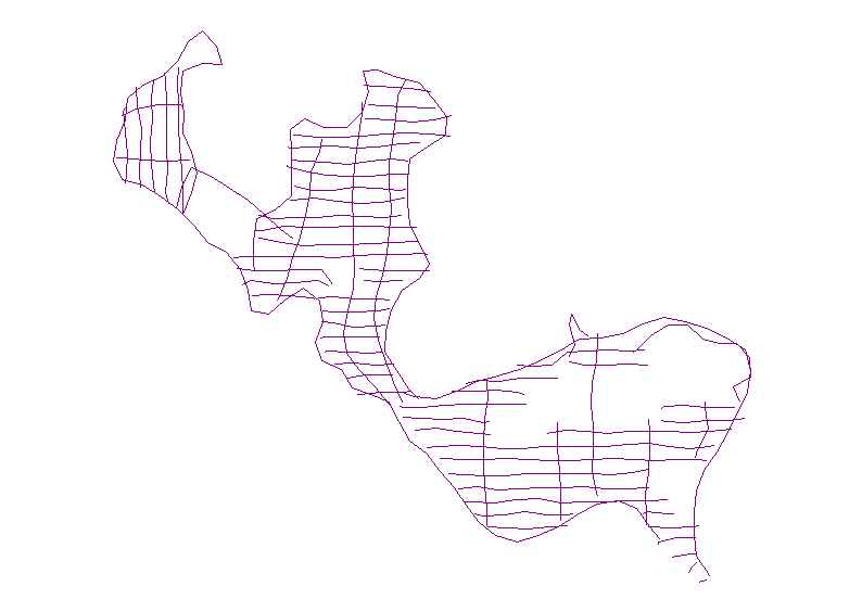
| 2005-004-FA_sonartrk Klein 3000 sidescan-sonar survey tracklines collected by the USGS in Moultonborough Bay, Lake Winnipesaukee, New Hampshire in 2005 (Geographic, WGS 84, Esri polyline shapefile and CSV file formats) |
 |
HTML FAQ TEXT XML |
2005-004-FA_sonartrk.zip 82 KB |
| winni_sonar.tif 1-meter per pixel sidescan-sonar mosaic collected by the USGS in Moultonborough Bay, Lake Winnipesaukee, New Hampshire in 2005 (UTM Zone 19N, WGS 84 GeoTIFF image format) |
 |
HTML FAQ TEXT XML |
winni_sonar.zip 1.52 MB |
Videos |
|||
| 2005-004-FA_videotrk Trackline navigation for video data from 40 sample locations collected by the USGS in Moultonborough Bay, New Hampshire in 2005 (Geographic, WGS 84, Esri polyline shapefile and CSV file formats) |
 |
HTML FAQ TEXT XML |
2005-004-FA_videotrk.zip 89 KB |
Samples |
|||
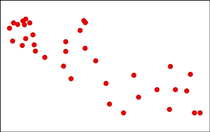
| 2005-004-FA-samples Sediment samples and textural properties at 40 sample locations collected by the USGS in Moultonborough Bay, New Hampshire in 2005 (Geographic, WGS 84, Esri point shapefile and CSV file formats) |
 |
HTML FAQ TEXT XML |
2005-004-FA_samples.zip 102 KB |
Navigation |
|||
| 2005-004-FA_hypack Text files of the Wide Area Augmentation System (WAAS) navigation collected by the USGS in Moultonborough Bay, Lake Winnipesaukee, New Hampshire in 2005 (Geographic, WGS 84, HYPACK ASCII text file formats) |
no preview available | HTML FAQ TEXT XML |
2005-004-FA_hypack.zip 5.52 MB |