Location of bottom photographs along with images collected by the U.S. Geological Survey in 2014 along the Delmarva Peninsula, MD and VA (JPEG images and Esri point shapefile, Geographic, WGS 84)

Metadata also available as - [Outline] - [Parseable text] - [XML]

Frequently anticipated questions:


What does this data set describe?

Title:
Location of bottom photographs along with images collected by the U.S. Geological Survey in 2014 along the Delmarva Peninsula, MD and VA (JPEG images and Esri point shapefile, Geographic, WGS 84)
Abstract:
The Delmarva Peninsula is a 220-kilometer-long headland, spit, and barrier island complex that was significantly affected by Hurricane Sandy. A U.S. Geological Survey cruise was conducted in the summer of 2014 to map the inner continental shelf of the Delmarva Peninsula using geophysical and sampling techniques to define the geologic framework that governs coastal system evolution at storm-event and longer timescales. Data collected during the 2014 cruise include swath bathymetry, sidescan sonar, chirp and boomer seismic-reflection profiles, acoustic Doppler current profiler, and sample and bottom photograph data. Processed data in raster and vector format are released here for the bottom photographs and sediment samples. More information about the USGS survey conducted as part of the Hurricane Sandy Response-- Geologic Framework and Coastal Vulnerability Study can be found at the project website or on the WHCMSC Field Activity Web pages: https://woodshole.er.usgs.gov/project-pages/delmarva/ and https://cmgds.marine.usgs.gov/fan_info.php?fan=2014-002-FA
  1. How might this data set be cited?
    U.S. Geological Survey, 2015, Location of bottom photographs along with images collected by the U.S. Geological Survey in 2014 along the Delmarva Peninsula, MD and VA (JPEG images and Esri point shapefile, Geographic, WGS 84): data release DOI:10.5066/F7MW2F60, U.S. Geological Survey, Coastal and Marine Geology Program, Woods Hole Coastal and Marine Science Center, Woods Hole, Massachusetts.

    Online Links:

    This is part of the following larger work.

    Pendleton, E. A., Ackerman, S.D., Baldwin, W.E., Danforth, W.W., Foster, D.S., Thieler, E.R., and Brothers, L.L., 2015, High-resolution geophysical data collected along the Delmarva Peninsula 2014, U.S. Geological Survey Field Activity 2014-002-FA: data release DOI:10.5066/F7MW2F60, U.S. Geological Survey, Reston, VA.

    Online Links:

  2. What geographic area does the data set cover?
    West_Bounding_Coordinate: -75.520736
    East_Bounding_Coordinate: -74.826439
    North_Bounding_Coordinate: 38.406095
    South_Bounding_Coordinate: 37.589722
  3. What does it look like?
    https://cmgds.marine.usgs.gov/data/field-activity-data/2014-002-FA/data/imagery/hero_pic.png (PNG)
    Woods Hole Coastal and Marine Science Center sample bottom photograph from along the Delmarva Peninsula
  4. Does the data set describe conditions during a particular time period?
    Beginning_Date: 22-Jul-2014
    Ending_Date: 25-Jul-2014
    Currentness_Reference:
    ground condition; sample and photo data were collected after geophysical data collection was complete.
  5. What is the general form of this data set?
    Geospatial_Data_Presentation_Form: vector and raster digital data
  6. How does the data set represent geographic features?
    1. How are geographic features stored in the data set?
      This is a Vector data set. It contains the following vector data types (SDTS terminology):
      • Entity point (39)
    2. What coordinate system is used to represent geographic features?
      Horizontal positions are specified in geographic coordinates, that is, latitude and longitude. Latitudes are given to the nearest 0.000001. Longitudes are given to the nearest 0.000001. Latitude and longitude values are specified in Decimal degrees. The horizontal datum used is D_WGS_1984.
      The ellipsoid used is WGS_1984.
      The semi-major axis of the ellipsoid used is 6378137.000000.
      The flattening of the ellipsoid used is 1/298.257224.
  7. How does the data set describe geographic features?
    2014_002_FA_Photos
    Bottom photographs and locations (Source: U.S. Geological Survey)
    FID
    Internal feature number. (Source: Esri) Sequential unique whole numbers that are automatically generated.
    Shape
    Feature geometry. (Source: Esri) Coordinates defining the features.
    TIME
    UTC time of bottom photograph collection in format HH:MM:SS. (Source: U.S. Geological Survey) UTC time of bottom photograph collection
    PICNAME
    Name of bottom photograph used to uniquely identify between surveys, stations, cameras, and photographs. Format: surveynumber_heronumber_sampleday_Gnumber.JPG; Example: 2014002_h3_d09_G0045248.JPG. (Source: U.S. Geological Survey) String used to distinguish photographs
    LONG
    Longitude in Geographic Coordinates, WGS 84. (Source: U.S. Geological Survey)
    Range of values
    Minimum:-75.520736
    Maximum:-74.826439
    Units:degrees
    Resolution:0.000001
    LAT
    Latitude in Geographic Coordinates, WGS 84. (Source: U.S. Geological Survey)
    Range of values
    Minimum:37.589722
    Maximum:38.406095
    Units:degrees
    Resolution:0.000001
    JD
    Julian day; Julian day is the integer number representing the interval of time in days since January 1 of the year. (Source: U.S. Geological Survey)
    Range of values
    Minimum:203
    Maximum:206
    Units:days
    Resolution:1
    FIELD_NO
    Name of station ID that corresponds to photograph and sample locations. (Source: U.S. Geological Survey) String used to organize sample and photograph locations.
    CLASSIFICA
    Sediment Classification - Sediment description based on a rigorous definition, usually Shepard (1954) as modified by Schlee (1973) and Poppe and others (2005). (Source: USGS East Coast Sediment Texture Database data dictionary)
    ValueDefinition
    CLAYEY SILTSediment whose main phase is silt, but with significant clay.
    GRAVELSediment whose main phase (equal to or greater than 50 percent) is greater than 2 mm.
    GRAVELLY SEDIMENTSediment whose phase is equal to or greater than 10 percent, but less than 50 percent gravel, but with significant other sediment.
    SANDSediment whose main phase is less than 2 mm, but greater than or equal to 0.062 mm.
    SAND SILT CLAYSediment with significant (over 20 percent) sand, silt, and clay.
    SANDY SILTSediment whose main phase is silt, but with significant sand.
    SILTY SANDSediment whose main phase is clay, but with significant silt.
    CRUISE_ID
    WHCMSC field activity identifier (e.g. "2014-002-FA" where 2014 is the survey year, 002 is survey number of that year, and FA is Field Activity) (Source: U.S. Geological Survey) String used to distinguish cruises by year and ID number
    DEVICE_ID
    Device used to collect the sample and bottom photograph. (Source: U.S. Geological Survey) String used to identify the SEABOSS configuration used during the survey
    VEHICLE_ID
    Vehicle used to collect data during survey 2014-002-FA. (Source: U.S. Geological Survey) String used to identify the survey vessel
    CAMERA
    GoPro camera used to collect bottom photograph (Source: U.S. Geological Survey) String used to distinguish between 2 GoPro cameras mounted on the SEABOSS Mark II
    Entity_and_Attribute_Overview:
    The JPEG images can be hyperlinked to their shapefile location in ArcGIS.
    Entity_and_Attribute_Detail_Citation: U.S. Geological Survey

Who produced the data set?

  1. Who are the originators of the data set? (may include formal authors, digital compilers, and editors)
    • U.S. Geological Survey
  2. Who also contributed to the data set?
  3. To whom should users address questions about the data?
    Elizabeth A. Pendleton
    U.S. Geological Survey
    Geologist
    384 Woods Hole Road
    Woods Hole, MA
    USA

    508-548-8700 x2259 (voice)
    508-457-2310 (FAX)
    ependleton@usgs.gov

Why was the data set created?

This dataset is used to display the images and locations of bottom photographs acquired with a GoPro modified, mid-sized SEABed OBservation and Sampling System (SEABOSS Mark II configuration) collected during a 2014 USGS cruise along the Delmarva Peninsula. The information contained within the bottom photographs is needed to validate geophysical data. This dataset contains an image from each bottom photograph station, as well as location in easting and northing (UTM, Zone 18N, WGS84, meters), time of day and date of collection. Physical sediment samples, which also may provide information about the seabed, were also collected at photograph stations and analyzed in the sediment laboratory at the USGS Woods Hole Coastal and Marine Science Center (see shapefile 2014_002_samples.shp)

How was the data set created?

  1. From what previous works were the data drawn?
    raw hypack nav and bottom photographs (source 1 of 1)
    U.S. Geological Survey, 2015, Bottom photographs and locations.

    Type_of_Source_Media: disc
    Source_Contribution:
    Bottom photographs and sediment samples were acquired to validate the seafloor interpretations made from geophysical data. Often sediment samplers are unable to recover large-diameter particles, so photographs can document the seafloor character in areas where samples may not be obtained. Two GoPro cameras were mounted to a USGS SEABOSS (Mark II configuration) with a modified VanVeen sampler frame. Approximate SEABOSS dimensions are 115 X 115 X 117 cm. The Van Veen sampler is housed at the bottom and center of the frame at approximately 30 X 32 X 16 cm with a 1/10 sq. meter sample capacity. Two red lasers were mounted on the frame above the sampler, 20 cm apart for scale in bottom photographs. 1 Keldan (Advanced Lighting Technology) light was mounted at the top of the frame and aimed downward to illuminate the seabed for photographs. 2 GoPro cameras were mounted on the frame and set to capture photographs at 2 or 5 second intervals. The GoPro Hero 2 was mounted approximately 70 cm from the bottom of the SEABOSS frame and captured photographs at 2-second interval. The GoPro Hero 3 was mounted approximately 20 cm from the bottom of the SEABOSS frame and captured video and photographs at 5-second interval. Because the frame was stationary on the bottom of the seabed only one photograph was chosen to represent the seafloor at each station location. Photographs collected in the water column, on the ship's deck, and duplicate photos of the seafloor were deleted.
  2. How were the data generated, processed, and modified?
    Date: 2015 (process 1 of 10)
    DGPS navigation for the Hemisphere receiver located on the acquisition van were logged in HYPACK software (version 14.0.9.47). A python script called parseHYPACK_gui_sort_all.py was used to search all HYPACK files from the sampling Julian days and pull out the GPGGA (nav) string and time and write out a parsed navigation file for all the sample and photograph Person who carried out this activity:
    Seth Ackerman
    U.S. Geological Survey
    Geologist
    384 Woods Hole Rd.
    Woods Hole, MA

    (508) 548-8700x2315 (voice)
    (508) 457-2310 (FAX)
    sackerman@usgs.gov
    Date: 2015 (process 2 of 10)
    Time of bottom photograph was extracted from the "Date Picture Taken" attribute in the EXchangeable Image File format (EXIF) header of the quality JPEG bottom photograph using a python tool called: JPEG_exifextract_gui_sort.py. A separate picture time file was created for each camera, Hero 2 and Hero 3. Person who carried out this activity:
    Seth Ackerman
    U.S. Geological Survey
    Geologist
    384 Woods Hole Rd.
    Woods Hole, MA

    (508) 548-8700x2315 (voice)
    (508) 457-2310 (FAX)
    sackerman@usgs.gov
    Date: 2015 (process 3 of 10)
    Adjustments were made manually to the time picture taken file to account for time offsets between the time recorded in the JPEG EXIF "Date Picture Taken" attribute and the GPS time as verified by comparing calibration photos taken on the deck of the ship. Hero 2 was 12 seconds behind GPS time and Hero 3 was 19 seconds behind GPS time. To account for the time difference, an additional field was added to the photo 'time picture taken' file generated in the previous step. The new field of the time difference was populated using Microsoft Excel (version 2010) by auto-filling a linear series. The time difference is used for geolocating the photos in the subsequent processing step. Person who carried out this activity:
    Seth Ackerman
    U.S. Geological Survey
    Geologist
    384 Woods Hole Rd.
    Woods Hole, MA

    (508) 548-8700x2315 (voice)
    (508) 457-2310 (FAX)
    sackerman@usgs.gov
    Date: 2015 (process 4 of 10)
    An Esri shapefile was created by using a python script (photo_locs_gui_5exif.py) to join the bottom photo with the parsed HYPACK navigation file by matching the smallest time offset field for Hero 2 photos (12 seconds) and Hero 3 photos (19 seconds). Person who carried out this activity:
    Seth Ackerman
    U.S. Geological Survey
    Geologist
    384 Woods Hole Rd.
    Woods Hole, MA

    (508) 548-8700x2315 (voice)
    (508) 457-2310 (FAX)
    sackerman@usgs.gov
    Date: 2015 (process 5 of 10)
    Several unnecessary attribute fields were deleted from the bottom photograph shapefile, such as “GPS time” and “time offset”. Attribute fields for the accompanying sediment sample (FIELD_NO) and the sediment classification (Folk scheme) of the accompanying sediment sample (CLASSIFICA) were added to the shapefile in Esri ArcGIS (version 10.2.2) using the Spatial Join Tool. Person who carried out this activity:
    Seth Ackerman
    U.S. Geological Survey
    Geologist
    384 Woods Hole Rd.
    Woods Hole, MA

    (508) 548-8700x2315 (voice)
    (508) 457-2310 (FAX)
    sackerman@usgs.gov
    Date: 2015 (process 6 of 10)
    XTools Pro (version 12.0) for ArcGIS (version 10.2.2) was used to add new fields (Table Operations --> Table Restructure) to the point shapefile including an attribute for the survey ID (CRUISE_ID), device used to collect the photos & samples (DEVICE_ID), the survey vessel (VEHICLE_ID), and the Camera (CAMERA: either Hero2 or Hero3) Finally, the two separate camera shapefiles (Hero2 & Hero3) were merged into one shapefile using ArcToolbox (version 10.2.2) Merge (data management -tool). Person who carried out this activity:
    Elizabeth Pendleton
    U.S. Geological Survey
    Geologist
    384 Woods Hole Rd.
    Woods Hole, MA

    (508) 548-8700x2259 (voice)
    (508) 457-2310 (FAX)
    ependleton@usgs.gov
    Date: 03-Dec-2014 (process 7 of 10)
    The photo locations were exported from ArcMap 9.3.1 using XTools Pro 7.1 as a comma-delimited text file. The attributes chosen for export were: TIME, PICNAME, LONG, LAT. Another column of information was added - yrdate - which had the year and date the photograph was taken in the format YYYYMMDD. This information was based on the Julian dat in the shapefile. A Python version 2.7.3 script (writeexif_2_readfile_11_24_15.py) was then run that incorporated this information, along with additional information, into the appropriate locations in the EXIF header of each full-resolution JPEG image. The PYTHON script uses ExifTool (version 9.4.6.0) to write the information to the image headers of the full-resolution images. These images will eventually be incorporated into the WHCMSC photo database and the EXIF header information is a requirement for the database.
    
    
    The following tags were populated in the JPEG image headers. Information is duplicated in some tags. This was done because different software packages access different tags.
    
    
    GPS tags: The values populated are unique for each image and based on the information exported from the photo locations shapefile.
    GPSLatitudeRef
    GPSLatitude
    GPSLongitudeRef
    GPSLongitude
    GPSTimeStamp
    GSPDateStamp
    
    
    JPEG tags: The tag is listed along with the information used to populate it - which is the same for every image taken with a particular camera. The following information is based on the GoPro Hero 2 camera.
    
    
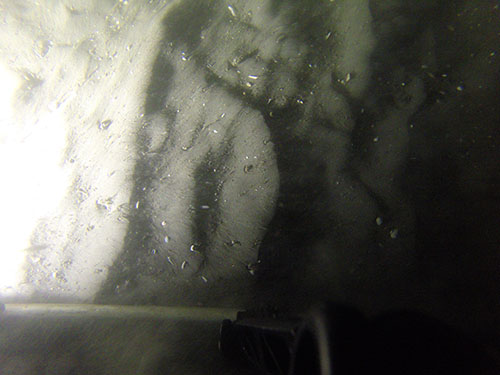
    comment: Photo from down-looking GoPro HERO 2 camera on the USGS SEABOSS deployed from the M/V Scarlett Isabella during survey 2014-002-FA (http://cmgds.marine.usgs.gov/fan_info.php?fan=2014-002-FA). Released as part of publication DOI:10.5066/F7MW2F60.
    
    
    EXIF tags: The tag is listed along with the information used to populate it - which is the same for every image.
    
    
    ImageDescription: Photograph of the sea floor along the Delmarva Peninsula, MD and VA from survey 2014-002-FA
    Artist: Seth Ackerman
    Copyright: Public Domain - please credit U.S. Geological Survey
    
    
    IPTC tags: The tag is listed along with the information used to populate it - which is the same for every image.
    Credit: U.S. Geological Survey
    Contact: sackerman@usgs.gov
    Keywords: Delmarva Peninsula, 2014-002-FA, SEABOSS, sea floor, USGS, GoPro HERO 2
    CopyrightNotice: Public Domain - please credit U.S. Geological Survey
    Caption-Abstract: Photograph of the sea floor along the Delmarva Peninsula, MD and VA from survey 2014-002-FA
    
    
    XMP tags: The tag is listed along with the information used to populate it - which is the same for every image.
    Caption: Photograph of the sea floor along the Delmarva Peninsula, MD and VA from survey 2014-002-FA
    
    
    To extract the information from the image headers using ExifTool, the following command can be used (tested with ExifTool version 9.4.6.0):
    
    
    exiftool.exe -csv -f -filename -GPSTimeStamp -GPSLongitude -GPSLatitude -n -Artist -Credit -comment -keywords -Caption -Copyright -CopyrightNotice -Caption-Abstract -ImageDescription hero2/*.jpg > out.csv
    
    
    The -csv flag writes the information out in a comma-delimited format. The -n option formats the latitude and longitude as signed decimal degrees.
    
    
    The following tags are modified for the hero3 files.
    
    
    comment=Photo from down-looking GoPro HERO 3+ camera on the USGS SEABOSS deployed from the M/V Scarlett Isabella during survey 2014-002-FA (http://cmgds.marine.usgs.gov/fan_info.php?fan=2014-002-FA). Released as part of publication DOI:10.5066/F7MW2F60.
    
    
    keywords=Delmarva Peninsula, 2014-002-FA, SEABOSS, sea floor, USGS, GoPro HERO 3+ Person who carried out this activity:
    U.S. Geological Survey
    Attn: VeeAnn A. Cross
    Marine Geologist
    384 Woods Hole Rd.
    Woods Hole, MA

    508-548-8700 x2251 (voice)
    508-457-2310 (FAX)
    vatnipp@usgs.gov
    Date: 18-Apr-2017 (process 8 of 10)
    The online links to the data were updated to reflect the new server hosting the data. Additionally, other small edits could be made to the metadata, such as modifying http to https where appropriate. The metadata date (but not the metadata creator) was edited to reflect the date of these changes. Person who carried out this activity:
    U.S. Geological Survey
    Attn: VeeAnn A. Cross
    Marine Geologist
    384 Woods Hole Road
    Woods Hole, MA

    508-548-8700 x2251 (voice)
    508-457-2310 (FAX)
    vatnipp@usgs.gov
    Date: 20-Jul-2018 (process 9 of 10)
    USGS Thesaurus keywords added to the keyword section. Person who carried out this activity:
    U.S. Geological Survey
    Attn: VeeAnn A. Cross
    Marine Geologist
    384 Woods Hole Road
    Woods Hole, MA

    508-548-8700 x2251 (voice)
    508-457-2310 (FAX)
    vatnipp@usgs.gov
    Date: 08-Sep-2020 (process 10 of 10)
    Added keywords section with USGS persistent identifier as theme keyword. Person who carried out this activity:
    U.S. Geological Survey
    Attn: VeeAnn A. Cross
    Marine Geologist
    384 Woods Hole Road
    Woods Hole, MA

    508-548-8700 x2251 (voice)
    508-457-2310 (FAX)
    vatnipp@usgs.gov
  3. What similar or related data should the user be aware of?
    Blackwood, D., and Parolski, K., 2001, Seabed observation and sampling system: Sea Technology v. 42, no. 2, p. 29-43, Compass Publications, Inc., Arlington, VA.


How reliable are the data; what problems remain in the data set?

  1. How well have the observations been checked?
    The GoPro Hero 2 HD camera used on the SEABOSS Mark II acquires photos at 11 Megapixels in JPEG quality of 98 percent, so file sizes are generally between 3 and 7 MB on disc, depending on seabed complexity. The GoPro Hero 3+ black camera used on the SEABOSS Mark II acquires photos at 12 Megapixels in JPEG quality of 80%, so file sizes are generally between 1 and 3 MB on disc. Image quality and photo interval was reduced for Hero 3 to allow space on camera card for bottom video.
  2. How accurate are the geographic locations?
    Differential Global Positioning System (DGPS) navigation data were acquired with a Hemisphere receiver and recorded with HYPACK (www.hypack.com). The recorded position of each bottom photograph is the position of the GPS antenna on the survey vessel acquisition van, not the SEABOSS sampler. The SEABOSS was deployed approximately 5 meters astern of the GPS antenna off the ship's A-fame on the stern of the ship. No layback or offset was applied to the recorded position. In addition to the plus or minus 5 m offset, the SEABOSS may additionally drift away from the survey vessel when deployed to the seafloor. Based on the various sources of horizontal error, a conservative estimate of the horizontal accuracy of the bottom photograph location is 20-30 m.
  3. How accurate are the heights or depths?
  4. Where are the gaps in the data? What is missing?
    The best photograph from each station is included in a camera folder. If a quality photo was not obtained from either camera at a station, then the location is not included in the Esri shapefile and no image is available in the camera folder for Hero 2 or Hero 3.
  5. How consistent are the relationships among the observations, including topology?
    All bottom photographs were acquired with the same 2 cameras; a GoPro Hero 2 HD (Hero2) and a GoPro Hero 3+ black (Hero3). Cameras were mounted on a mid-sized SEABOSS with a modified VanVeen Sampler. Gaps in sequential photo numbers exist because only the best photo per station was selected for publication (See source contribution for more information on camera settings and photograph timing). Some stations did not obtain a quality photo due to frame movement, or an unsettled (muddy) seabed. Of 133 sample stations, Hero 2 recovered quality photos for 106 stations, and Hero 3 recovered quality photos at 99 stations.

How can someone get a copy of the data set?

Are there legal restrictions on access or use of the data?
Access_Constraints: None
Use_Constraints:
Public domain data from the U.S. Government are freely redistributable with proper metadata and source attribution. Please recognize the U.S. Geological Survey as the originator of the dataset.
  1. Who distributes the data set? (Distributor 1 of 1)
    Elizabeth A. Pendleton
    U.S. Geological Survey
    Geologist
    384 Woods Hole Rd.
    Woods Hole, MA

    (508) 548-8700x2259 (voice)
    (508) 457-2310 (FAX)
    ependleton@usgs.gov
  2. What's the catalog number I need to order this data set? USGS data release 2014-002-FA file contains bottom photograph locations and images of the seafloor collected by the U.S. Geological Survey (2014-002-FA_photos.zip). The zip file contains a folder with the following a shapefile with photograph locations (2014_002_FA_Photos.shp), and folders (names according to station ID) containing one JPG image per station. A browse graphic (hero_pic.png) and FGDC CSDGM metadata files (2014_002_FA_Photos.xml) in four standard formats are also included in the zip file.
  3. What legal disclaimers am I supposed to read?
    Neither the U.S. Government, the Department of the Interior, nor the USGS, nor any of their employees, contractors, or subcontractors, make any warranty, express or implied, nor assume any legal liability or responsibility for the accuracy, completeness, or usefulness of any information, apparatus, product, or process disclosed, nor represent that its use would not infringe on privately owned rights. The act of distribution shall not constitute any such warranty, and no responsibility is assumed by the USGS in the use of these data or related materials. Any use of trade, product, or firm names is for descriptive purposes only and does not imply endorsement by the U.S. Government.
  4. How can I download or order the data?
  5. What hardware or software do I need in order to use the data set?
    This zip file contains data available point shapefile format. The user must have software capable of reading shapefile format to use these data. An image viewer can be used to see the JPG images.

Who wrote the metadata?

Dates:
Last modified: 08-Sep-2020
Metadata author:
Elizabeth Pendleton
U.S. Geological Survey
Geologist
384 Woods Hole Rd.
Woods Hole, MA

(508) 548-8700x2259 (voice)
(508) 457-2310 (FAX)
ependleton@usgs.gov
Metadata standard:
FGDC Content Standards for Digital Geospatial Metadata (FGDC-STD-001-1998)

This page is <https://cmgds.marine.usgs.gov/catalog/whcmsc/field_activities/2014_002_fa/2014_002_FA_Photos.faq.html>
Generated by mp version 2.9.50 on Tue Sep 21 18:20:14 2021