Online Links:
Online Links:
| Value | Definition |
|---|---|
| 2021-022-FA | USGS year, ID, and Field Activity |
| Value | Definition |
|---|---|
| 999 | Null value |
| Range of values | |
|---|---|
| Minimum: | 3 |
| Maximum: | 3 |
| Range of values | |
|---|---|
| Minimum: | 1 |
| Maximum: | 7020 |
| Value | Definition |
|---|---|
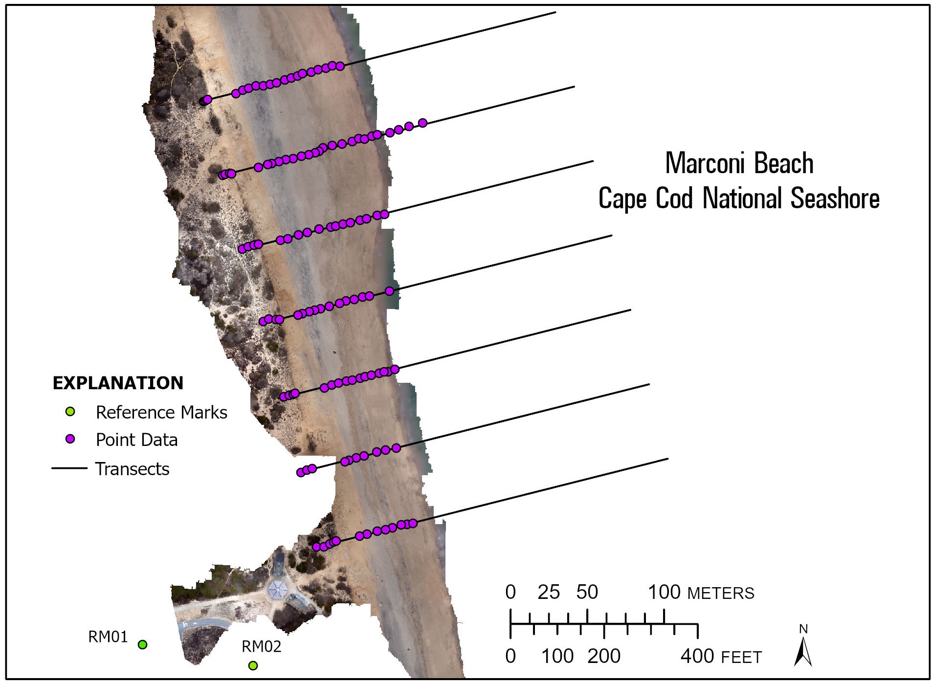
| RM02_OPEN, RM01_CLOSE, RM02_OPEN, RM02_CLOSE, TRAN#, AERO###, ac######## | RM stands for Reference Mark with CLOSE and OPEN referring to the end or beginning of the survey (see 2021022FA_Marconi_ReferenceMark01.txt and 2021022FA_Marconi_ReferenceMark02.txt for OPUS values of the reference marks); TRAN #, where TRAN represents the transect and the # is a value between 1 and 7 referencing the 2021022FA_Marconi_Transects.shp; AERO### refers to an RTK surveyed AeroPoint and # is the last three digits printed on the AeroPoint; and ac######## refer to AeroPoint Global IDs, ac followed by a string of eight numbers and letters. |
| Range of values | |
|---|---|
| Minimum: | 420117.401 |
| Maximum: | 4638533.240 |
| Units: | meters |
| Range of values | |
|---|---|
| Minimum: | 419995.614 |
| Maximum: | 4638476.888 |
| Units: | meters |
| Range of values | |
|---|---|
| Minimum: | -2.630 |
| Maximum: | 18.630 |
| Units: | meters |
| Range of values | |
|---|---|
| Minimum: | 41.89117591 |
| Maximum: | 41.89469982 |
| Units: | decimal degrees |
| Range of values | |
|---|---|
| Minimum: | -69.96223257 |
| Maximum: | -69.96438619 |
| Units: | decimal degrees |
| Value | Definition |
|---|---|
| 999 | Null value |
| Range of values | |
|---|---|
| Minimum: | -26.949 |
| Maximum: | -24.545 |
| Units: | meters |
| Range of values | |
|---|---|
| Minimum: | 20210310 |
| Maximum: | 20210317 |
| Units: | YYYYMMDD |
| Range of values | |
|---|---|
| Minimum: | 10:12:00 |
| Maximum: | 15:14:00 |
| Units: | HH:MM:SS EST |
| Value | Definition |
|---|---|
| 999 | Null value |
| Range of values | |
|---|---|
| Minimum: | 0.0001 |
| Maximum: | 0.0160 |
| Units: | meters |
| Value | Definition |
|---|---|
| 999 | Null value |
| Range of values | |
|---|---|
| Minimum: | 0.0002 |
| Maximum: | 0.0120 |
| Units: | meters |
| Value | Definition |
|---|---|
| 999 | Null value |
| Range of values | |
|---|---|
| Minimum: | 0.0003 |
| Maximum: | 0.0180 |
| Units: | meters |
| Range of values | |
|---|---|
| Minimum: | 0 |
| Maximum: | 6 |
| Range of values | |
|---|---|
| Minimum: | 1 |
| Maximum: | 7 |
| Access_Constraints | None |
|---|---|
| Use_Constraints | Public domain data from the U.S. Government are freely redistributable with proper metadata and source attribution. Although these data have been processed successfully on a computer system at the U.S. Geological Survey (USGS), no warranty expressed or implied is made regarding the display or utility of the data for other purposes, nor on all computer systems, nor shall the act of distribution constitute any such warranty. The USGS or the U.S. Government shall not be held liable for improper or incorrect use of the data described and/or contained herein. Not for navigational use. Please recognize the U.S. Geological Survey (USGS) as the source of this information. |
| Data format: | The CSV file 2021022FA_Marconi_nav_AeroPoints.csv contains ground control (AeroPoint) data in format CSV (version Exported from Excel Office 365 16.01) Size: 0.02 |
|---|---|
| Network links: |
https://cmgds.marine.usgs.gov/data/field-activity-data/2021-022-FA/data/Navigation/2021022FA_Marconi_nav_AeroPoints.csv https://cmgds.marine.usgs.gov/data/field-activity-data/2021-022-FA https://doi.org/10.5066/P9KSG1RQ |
| Data format: | The zip file contains 2021022FA_Marconi_nav_transects.shp: a point shapefile format of survey data, 2021022FA_Marconi_Transects: a line shapefile of the transects, and 20210922FA_Marconi_nav_transects.csv: file with pole survey data. in format Shapefile and CSV (version ArcGIS 10.7.1 and Excel Office 365 16.01) Size: 0.49 |
|---|---|
| Network links: |
https://cmgds.marine.usgs.gov/data/field-activity-data/2021-022-FA/data/Navigation/2021022FA_Marconi_navigation.zip https://cmgds.marine.usgs.gov/data/field-activity-data/2021-022-FA/ https://doi.org/10.5066/P9POZ9VH |
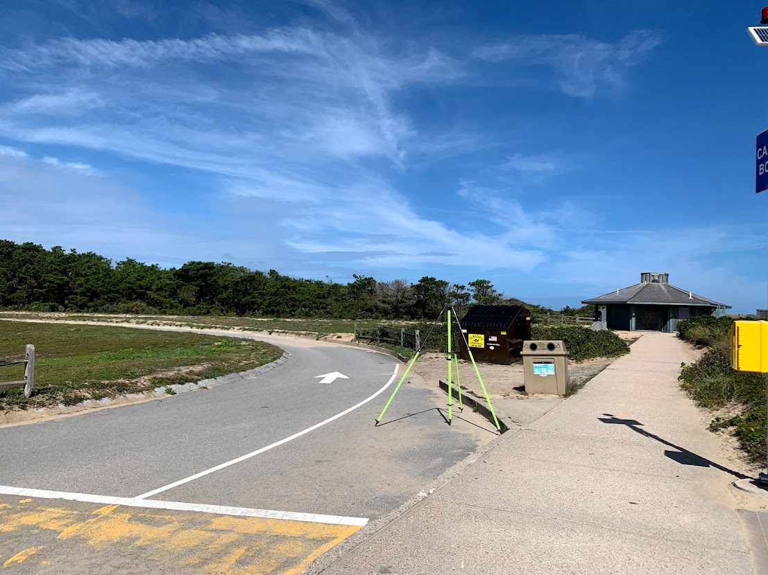
| Data format: | Text file, 2021022FA_Marconi_ReferenceMark01.txt, that contains the OPUS solution to Reference Mark 1 established at Marconi Beach in January 2021. in format ASCII Size: 0.01 |
|---|---|
| Network links: |
https://cmgds.marine.usgs.gov/data/field-activity-data/2021-022-FA/data/Navigation/2021022FA_Marconi_ReferenceMark01.txt https://cmgds.marine.usgs.gov/data/field-activity-data/2021-022-FA/ https://doi.org/10.5066/P9POZ9VH |
| Data format: | Text file, 2021022FA_Marconi_ReferenceMark01.txt, that contains the OPUS solution to Reference Mark 2 established at Marconi Beach in January 2021. in format ASCII Size: 0.01 |
|---|---|
| Network links: |
https://cmgds.marine.usgs.gov/data/field-activity-data/2021-022-FA/data/Navigation/2021022FA_Marconi_ReferenceMark02.txt https://cmgds.marine.usgs.gov/data/field-activity-data/2021-022-FA/ https://doi.org/10.5066/P9POZ9VH |