Online Links:
Range of values | |
---|---|
Minimum: | -270 |
Maximum: | -5 |
Units: | meters |
Resolution: | 5 |
U.S. Geological Survey, National Oceanic and Atmospheric Administration, Canadian Hydrographic Service, University of New Brunswick
Development of a GIS database of sea floor imagery that is accessible to scientists, policymakers, managers, and the general public.
Are there legal restrictions on access or use of the data?Access_Constraints: None
Use_Constraints: None.
This publication was prepared by members of the US Geological Survey. Neither USGS or the United States Government nor any agency thereof, nor any of their employees, make any warranty, expressed or implied, or assumes any legal liability or responsibility for the accuracy, completeness, or usefulness of any information, apparatus, product, or process disclosed in this report, or represents that its use would not infringe privately owned rights. Reference therein to any specific commercial product, process, or service by trade name, trademark, manufacturer, or otherwise does not necessarily constitute or imply its endorsement, recommendation, or favoring by the United States Government or any agency thereof. Any views and opinions of authors expressed herein do not necessarily state or reflect those of the United States Government or any agency thereof.
Data format: | Bathymetric contours, quadrangle boundaries, coastline, and boundary of the Stellwagen Bank National Marine Sanctuary. in format ARCE (version 8.0) Size: 6 |
---|---|
Network links: |
http://pubs.usgs.gov/of/2000/of00-410/arcexprt/bathymer.e00 http://pubs.usgs.gov/of/2000/of00-410/arcexprt/coastmer.e00 http://pubs.usgs.gov/of/2000/of00-410/arcexprt/quadbnd.e00 http://pubs.usgs.gov/of/2000/of00-410/arcexprt/sbnmsbnd.e00 |
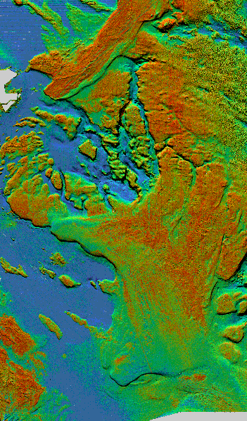
Data format: | Backscatter Imagery and Sun-Illuminated Sea Floor Topography in format TIFF (version 6.0) Size: 114 |
---|---|
Network links: |
http://pubs.usgs.gov/of/2000/of00-410/tif/sunillum.tif http://pubs.usgs.gov/of/2000/of00-410/tif/pseudo.tif |