Citation:
Citation_Information:
Originator: Larry Poppe
Publication_Date: 2009
Title:
High-Resolution Seismic-Reflection Chirp Profiles in SEG-Y and JPEG Formats From Cruise RAFA08034 off Edgartown, Massachusetts (08034_KELPROFILES)
Geospatial_Data_Presentation_Form: SEG-Y and JPEG
Series_Information:
Series_Name: Open-File Report
Issue_Identification: 2009-1001
Publication_Information:
Publication_Place: Woods Hole Coastal and Marine Science Center, Woods Hole, MA
Publisher: U.S. Geological Survey, Coastal and Marine Geology Program
Online_Linkage: https://doi.org/10.3133/ofr20091001
Online_Linkage: https://pubs.usgs.gov/of/2009/1001/html/catalog.html
Online_Linkage: https://pubs.usgs.gov/of/2009/1001/data/seismic/kel/segy/
Online_Linkage: https://pubs.usgs.gov/of/2009/1001/data/seismic/kel/jpeg_files/
Larger_Work_Citation:
Citation_Information:
Originator: L.J. Poppe
Originator: K.Y. McMullen
Originator: D.S. Foster
Originator: D.S. Blackwood
Originator: S.J. Williams
Originator: S.D. Ackerman
Originator: M.S. Moser
Originator: K.A. Glomb
Publication_Date: 2010
Title:
Geological Interpretation of the Sea Floor Offshore of Edgartown, Massachusetts
Edition: 1.0
Series_Information:
Series_Name: Open-File Report
Issue_Identification: 2009-1001
Publication_Information:
Publication_Place: Reston, VA
Publisher: U.S. Geological Survey
Online_Linkage: https://pubs.usgs.gov/of/2009/1001/
Description:
Abstract:
The U.S. Geological Survey (USGS), in cooperation with the National Oceanic and Atmospheric Administration (NOAA) and the Massachusetts Office of Coastal Zone Management (MA CZM), is producing detailed geologic maps of the coastal sea floor. Imagery, originally collected by NOAA for charting purposes, provides a fundamental framework for research and management activities along this part of the Massachusetts coastline, shows the composition and terrain of the seabed, and provides information on sediment transport and benthic habitat. Interpretive data layers were derived from multibeam echo-sounder and sidescan-sonar data collected in the vicinity of Edgartown Harbor, Massachusetts. During August 2008 seismic-reflection profiles (Boomer and Chirp) were acquired, and during September 2008 bottom photographs and surficial sediment data were acquired as part of two ground-truth reconnaissance surveys.
Purpose:
To release the Chirp seismic profiles collected to ground-truth acoustic data (single-beam and multibeam bathymetry and sidescan sonar imagery) collected during NOAA hydrographic survey H11346. The Chirp data were collected to interpret the shallower stratigraphy beneath Edgartown Harbor.
Supplemental_Information:
Time_Period_of_Content:
Time_Period_Information:
Range_of_Dates/Times:
Beginning_Date: 20080819
Ending_Date: 20080820
Currentness_Reference: ground condition
Status:
Progress: Complete
Maintenance_and_Update_Frequency: None planned
Spatial_Domain:
Bounding_Coordinates:
West_Bounding_Coordinate: -70.550201
East_Bounding_Coordinate: -70.432541
North_Bounding_Coordinate: 41.444981
South_Bounding_Coordinate: 41.385845
Keywords:
Theme:
Theme_Keyword_Thesaurus: USGS Metadata Identifier
Theme_Keyword: USGS:0540bff7-e962-4a44-94ee-4726f3ecc6dd
Theme:
Theme_Keyword_Thesaurus: None
Theme_Keyword: U.S. Geological Survey
Theme_Keyword: USGS
Theme_Keyword: USGS Woods Hole Coastal and Marine Science Center
Theme_Keyword: WHCMSC
Theme_Keyword: Coastal and Marine Geology Program
Theme_Keyword: CMGP
Theme_Keyword: RV Rafael
Theme_Keyword: SEG-Y format
Theme_Keyword: high-resolution seismic-reflection
Theme_Keyword: seismic profiles
Theme_Keyword: subbottom
Theme_Keyword: Knudsen Engineering Limited (KEL) Chirp 3200
Theme_Keyword: Field Activity Number 08034
Theme_Keyword: Open-File Report 2009-1001
Theme_Keyword: OFR 2009-1001
Theme_Keyword: JPEG format
Theme_Keyword: segy
Theme_Keyword: Chirp
Theme:
Theme_Keyword_Thesaurus: ISO 19115 Topic Category
Theme_Keyword: location
Theme_Keyword: oceans
Theme_Keyword: imageryBaseMapsEarthCover
Theme_Keyword: geoscientificInformation
Theme:
Theme_Keyword_Thesaurus: Data Categories for Marine Planning
Theme_Keyword: distributions
Theme_Keyword: substrate
Theme:
Theme_Keyword_Thesaurus: Marine Realms Information Bank (MRIB) Keywords
Theme_Keyword: seismic reflection profiling
Theme_Keyword: marine geophysics
Theme:
Theme_Keyword_Thesaurus: USGS Thesaurus
Theme_Keyword: seismic reflection methods
Theme_Keyword: sub-bottom profiling
Theme_Keyword: marine geophysics
Place:
Place_Keyword_Thesaurus: None
Place_Keyword: Cape Cod
Place_Keyword: Massachusetts
Place_Keyword: Nantucket Sound
Place_Keyword: northeast United States
Place_Keyword: North America
Place_Keyword: Atlantic Ocean
Place_Keyword: Edgartown
Place_Keyword: Edgartown Harbor
Place_Keyword: Martha's Vineyard
Access_Constraints: None
Use_Constraints:
Public domain data from the U.S. Government are freely redistributable with proper metadata and source attribution. Please recognize the U.S. Geological Survey (USGS) as the source of this information.
Point_of_Contact:
Contact_Information:
Contact_Person_Primary:
Contact_Person: Larry Poppe
Contact_Organization: U.S. Geological Survey
Contact_Position: Geologist
Contact_Address:
Address_Type: mailing and physical address
Address: 384 Woods Hole Road
City: Woods Hole
State_or_Province: MA
Postal_Code: 02543
Country: USA
Contact_Voice_Telephone: 508-548-8700 x2314
Contact_Facsimile_Telephone: 508-457-2310
Contact_Electronic_Mail_Address: [email protected]
Browse_Graphic:
Browse_Graphic_File_Name:
Browse_Graphic_File_Description:
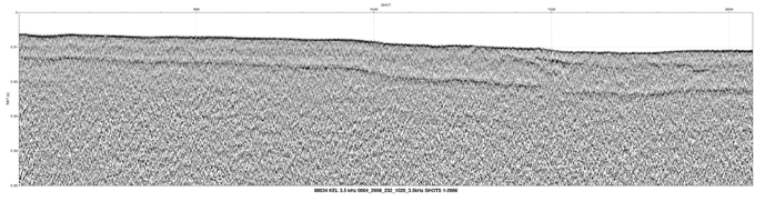
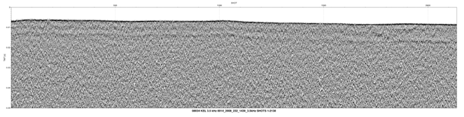
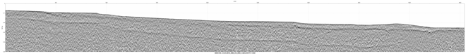
Browse graphic showing chirp high-resolution seismic-reflection profiles collected during RV Rafael cruise 08034.
Browse_Graphic_File_Type: GIF
Browse_Graphic:
Browse_Graphic_File_Name:
Browse_Graphic_File_Description:
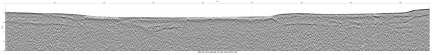
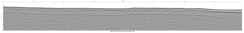
Browse graphic showing chirp high-resolution seismic-reflection profiles collected during RV Rafael cruise 08034.
Browse_Graphic_File_Type: GIF
Browse_Graphic:
Browse_Graphic_File_Name:
Browse_Graphic_File_Description:
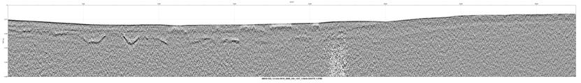
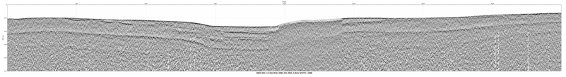
Browse graphic showing chirp high-resolution seismic-reflection profiles collected during RV Rafael cruise 08034.
Browse_Graphic_File_Type: GIF
Browse_Graphic:
Browse_Graphic_File_Name:
Browse_Graphic_File_Description:
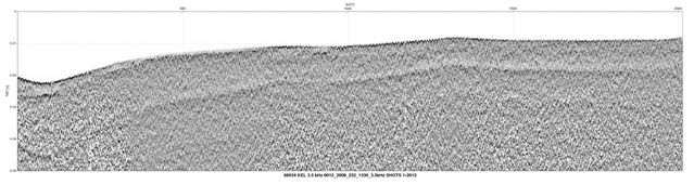
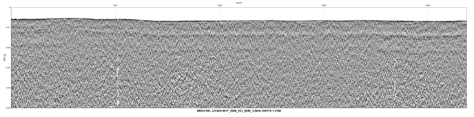
Browse graphic showing chirp high-resolution seismic-reflection profiles collected during RV Rafael cruise 08034.
Browse_Graphic_File_Type: GIF
Browse_Graphic:
Browse_Graphic_File_Name:
Browse_Graphic_File_Description:
Browse graphic showing chirp high-resolution seismic-reflection profiles collected during RV Rafael cruise 08034.
Browse_Graphic_File_Type: GIF
Browse_Graphic:
Browse_Graphic_File_Name:
Browse_Graphic_File_Description:
Browse graphic showing chirp high-resolution seismic-reflection profiles collected during RV Rafael cruise 08034.
Browse_Graphic_File_Type: GIF
Browse_Graphic:
Browse_Graphic_File_Name:
Browse_Graphic_File_Description:
Browse graphic showing chirp high-resolution seismic-reflection profiles collected during RV Rafael cruise 08034.
Browse_Graphic_File_Type: GIF
Browse_Graphic:
Browse_Graphic_File_Name:
Browse_Graphic_File_Description:
Browse graphic showing chirp high-resolution seismic-reflection profiles collected during RV Rafael cruise 08034.
Browse_Graphic_File_Type: GIF
Browse_Graphic:
Browse_Graphic_File_Name:
Browse_Graphic_File_Description:
Browse graphic showing chirp high-resolution seismic-reflection profiles collected during RV Rafael cruise 08034.
Browse_Graphic_File_Type: GIF
Browse_Graphic:
Browse_Graphic_File_Name:
Browse_Graphic_File_Description:
Browse graphic showing chirp high-resolution seismic-reflection profiles collected during RV Rafael cruise 08034.
Browse_Graphic_File_Type: GIF
Browse_Graphic:
Browse_Graphic_File_Name:
Browse_Graphic_File_Description:
Browse graphic showing chirp high-resolution seismic-reflection profiles collected during RV Rafael cruise 08034.
Browse_Graphic_File_Type: GIF
Browse_Graphic:
Browse_Graphic_File_Name:
Browse_Graphic_File_Description:
Browse graphic showing chirp high-resolution seismic-reflection profiles collected during RV Rafael cruise 08034.
Browse_Graphic_File_Type: GIF
Browse_Graphic:
Browse_Graphic_File_Name:
Browse_Graphic_File_Description:
Browse graphic showing chirp high-resolution seismic-reflection profiles collected during RV Rafael cruise 08034.
Browse_Graphic_File_Type: GIF
Browse_Graphic:
Browse_Graphic_File_Name:
Browse_Graphic_File_Description:
Browse graphic showing chirp high-resolution seismic-reflection profiles collected during RV Rafael cruise 08034.
Browse_Graphic_File_Type: GIF
Browse_Graphic:
Browse_Graphic_File_Name:
Browse_Graphic_File_Description:
Browse graphic showing chirp high-resolution seismic-reflection profiles collected during RV Rafael cruise 08034.
Browse_Graphic_File_Type: GIF
Browse_Graphic:
Browse_Graphic_File_Name:
Browse_Graphic_File_Description:
Browse graphic showing chirp high-resolution seismic-reflection profiles collected during RV Rafael cruise 08034.
Browse_Graphic_File_Type: GIF
Native_Data_Set_Environment:
Microsoft Windows XP Version 5.1 (Build 2600) Service Pack 3; ESRI ArcCatalog 9.2.6.1500
Cross_Reference:
Citation_Information:
Originator: C.J. O'Hara
Originator: R.N. Oldale
Publication_Date: 1987
Title:
Maps showing the geology, shallow structure, and bedform morphology of Nantucket Sound, Massachusetts
Edition: 1.0
Series_Information:
Series_Name: Miscellaneous Field Studies Map
Issue_Identification: MF-1911
Publication_Information:
Publication_Place: Reston, VA
Publisher: U.S. Geological Survey
Online_Linkage: https://pubs.er.usgs.gov/publication/mf1911