Home - Images - Products - Data - Publications - Contact
Back to Channel Islands Perspective Views

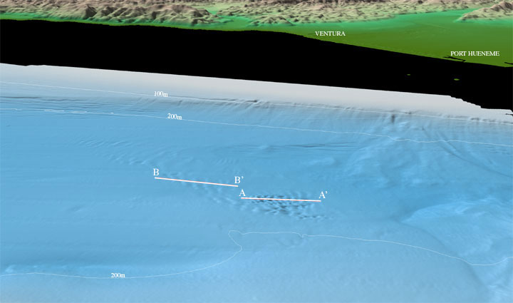
Perspective view of the Northeastern Channel Islands multibeam bathymetry looking north towards Ventura and Port Hueneme at the eastern end of the Santa Barbara Channel (arrow 6 on location map). In the center of the channel in about 230 m water depth are a field of bedform-like features. The larger features at A-A' have wavelengths on the order of 50 - 125 m with heights of about 3 - 12 m (see profile A-A' below). The smaller features at B-B' have lower relief (1 - 4 m), but have longer wavelengths of 200 m (see profile B-B' below). The distance across the bottom of the image is approximately 12 km. The vertical exaggeration is 2X.

Profile A-A' in figure 6 above. The profile crosses water depths from 224 - 246 m over a distance of about 1400 m.

Profile B-B' in figure 6 above. The profile crosses water depths from 224 - 232 m over a distance of about 1500 m.