Home - Images - Products - Data - Publications - Contact
Back to Crater Lake Perspective Views
Download a 300dpi TIFF Image (34mb)
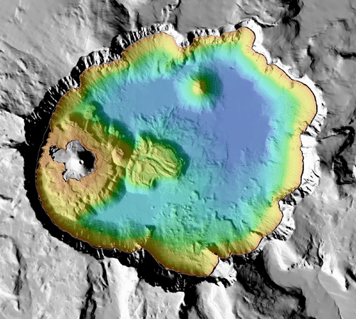
Map view of Crater Lake, Oregon. Colored region is the lake floor whereas the gray region is the surrounding land. The distance across the width if the lake is approximately 9 kilometers (5.6 miles). The reds and yellows show the shallower depths of the lake, whereas the greens and blues show the deeper depths.
