Home - Images - Products - Data - Publications - Contact
Back to Crater Lake Perspective Views
Download a 300dpi TIFF Image (no annotation) (27mb)
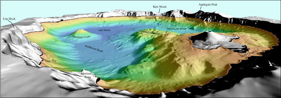
Oblique view of Crater Lake caldera looking southeast from Devils Backbone. The colored region is shaded-relief bathymetry of the lake floor and the gray region is shaded-relief topography of the surrounding caldera walls and Wizard Island. The distance across the bottom of the image is approximately 6 kilometers (3.7 miles).
