Home - Images - Products - Data - Publications - Contact
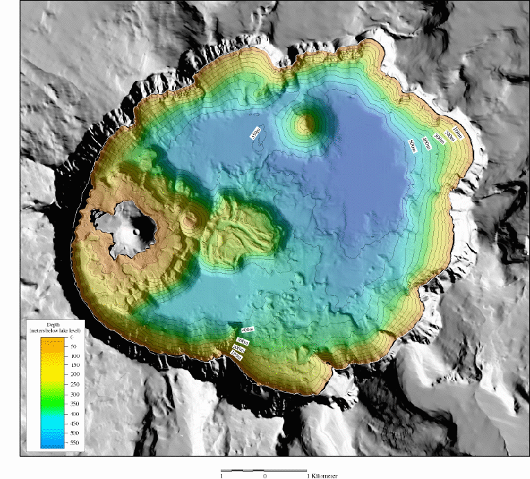
Shaded-relief bathymetry of Crater Lake, OR. The colored region is the lake floor, while the gray region is the surrounding mountains and Wizard Island. The width of the lake is about 9 kilometers (5.6 miles). The reds and yellows show the shallower depths of the lake, whereas the greens and blues show the deeper depths. The gray land area is generated from USGS 7.5 minute DEM's. Crater Lake occupies a caldera in Mount Mazama, a Cascade Range volcano that once stood about 3,700 meters (12,000 feet). Mount Mazama erupted about 7,700 years ago and collapsed upon itself to form the caldera shown in this view.
Field Activity metadata
