Home - Images - Products - Data - Publications - Contact
Return to Los Angeles Home Page
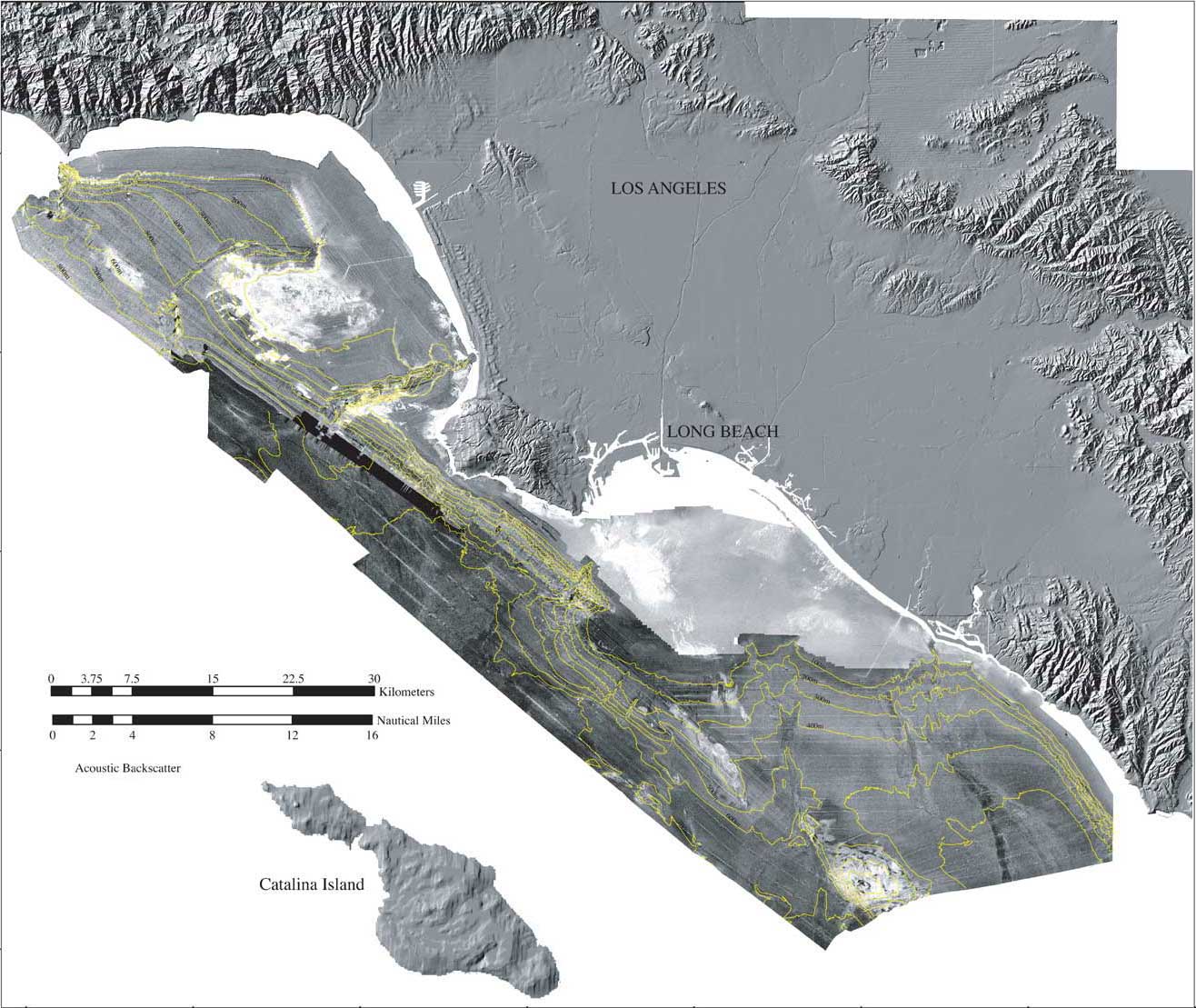
Acoustic backscatter of the Los Angeles, California Margin. The data were collected during three separate surveys (1996, 1998, and 1999) and merged together for this image. The brighter tones may indicate harder surfaces such as rock, while the the darker tones may indicate softer surfaces such as sediment.
NOTE: The different multibeam sonar systems used for each survey operate at different frequencies resulting in different backscatter intensities, depth of penetration, etc. While pixel values are relative to other values within a survey, pixel values are not relative between surveys. That is why there are sharp contrast boundaries between surveys in this image.