Home - Images - Products - Data - Publications - Contact
New Report: Predicted Seafloor Facies of Central Santa Monica Bay, California. USGS Open-File Report 2004-1081.
| (204 kb) (212 kb) |
|
|
Shaded Relief (204 kb) - Backscatter (212 kb) |
|
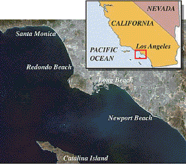
The Los Angeles Margin was mapped during three separate surveys. In 1996, the USGS surveyed the shelf and slope in Santa Monica Bay from Pt. Dume to the Palos Verdes Peninsula. The mapping was accomplished with a Kongsberg Simrad EM950 multibeam system that provided high-quality bathymetry and quantitative backscatter. In 1998, the USGS continued the mapping to the south and surveyed the outer shelf, slope, and proximal basin off Long Beach and Newport using a Kongsberg Simrad EM300 multibeam system. In 1999, the Los Angeles Margin mapping was completed with the surveying of the inner shelf from the Palos Verdes Peninsula, south to Newport. This survey used a Kongsberg Simrad EM3000D multibeam system. The three surveys are merged together into a single dataset shown on this website.
The three surveys were conducted to support USGS projects studying marine pollution and geohazards along the Los Angeles Margin.
The multibeam bathymetry and backscatter data can be download from an online report. Please reference:
Gardner, James V., and Peter Dartnell
Multibeam Mapping of the Los Angeles, California Margin
U.S. Geological Survey Open-File Report OF02-162
2002
Dartnell, Peter, and James V. Gardner. 2004. Predicted Seafloor Facies of Central Santa Monica Bay, California.
USGS Open-File Report 2004-1081.
Gardner, James V., and Peter Dartnell. 2002. Multibeam Mapping of the Los Angeles, California Margin.
USGS Open-File Report OF02-162.
Marlow, M.S., J.V. Gardner, W.R. Normark. 2000. Using high-resolution multibeam bathymetry to identify seafloor surface rupture along the Palos Verdes fault complex in offshore southern California.
Geology, July, 2000, v. 28, no. 7; pp. 587-590, doi: 10.1130/0091-7613(2000)28%3C587:UHMBTI%3E2.0.CO;2.
Cruise Report: RV Coastal Surveyor Cruise, C-1-99-SC, Multibeam Mapping of the Long Beach, California Continental Shelf. April 12 - May 19, 1999
USGS Open File Report 99-360. (636 kb).
Cruise Report; RV Ocean Alert Cruise A2-98-SC, Mapping the Sourthern California Continental Margin. March 26 - April 11, 1998.
USGS Open File Report: 98-475. Metadata
