USGS - science for a changing world

Pacific Coastal and Marine Science Center

Seafloor Mapping

Seafloor Mapping

Home - Images - Products - Data - Publications - Contact


Shaded Relief Bathymetry of the Los Angeles, California Margin

Return to Los Angeles Home Page

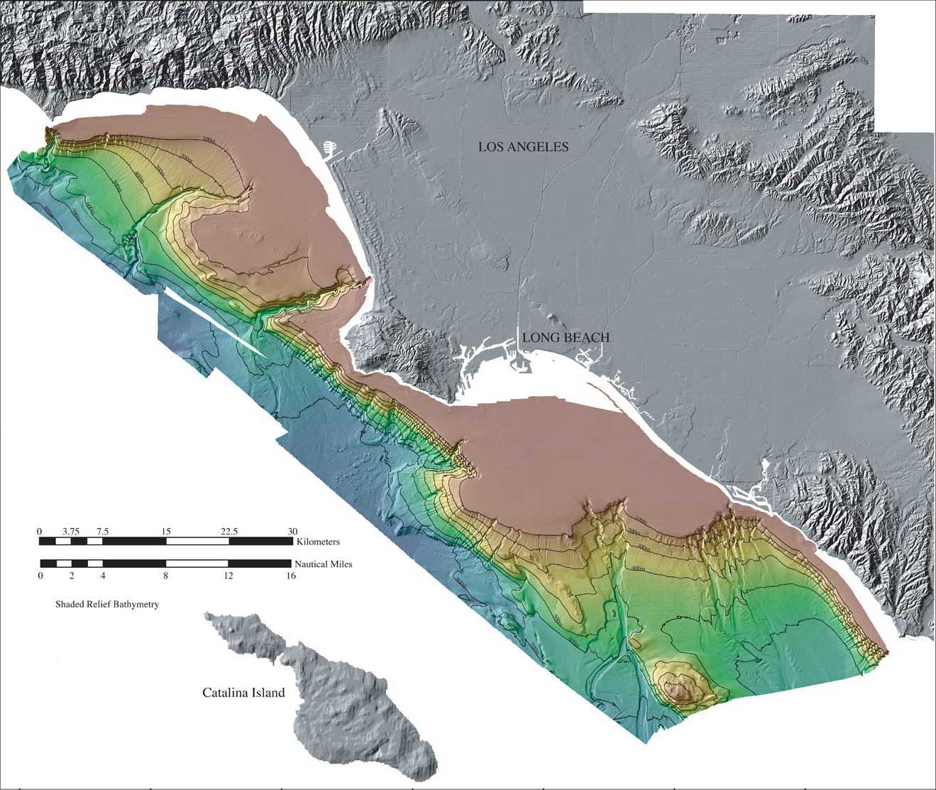
Color-coded shaded relief bathymetry of the Los Angeles, California Margin. The bathymetry data were collected during three separate surveys (1996, 1998, and 1999) and merged together. The reds show shallower depths, while the blues show deeper depths.
 

Los Angeles Margin shaded relief


Accessibility FOIA Privacy Policies and Notices

U.S. Department of the Interior | U.S. Geological Survey
URL: pacmaps/la_shd.html
Contact Peter Dartnell
Archived in 2018