Home - Images - Products - Data - Publications - Contact
Return to the Hog Island Perspective Views
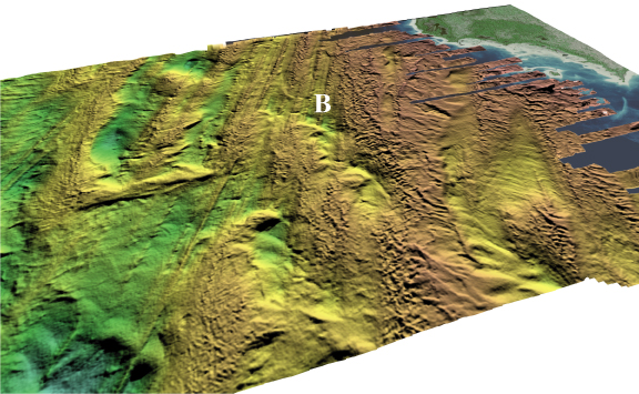
Oblique view looking west toward Hog Island. The pronounced northwest-southeast trending lineations in the center of the mapped area (B) die out to the north and appear buried by a coarse morphology that looks similar to the boulder and cobble areas seen at Boulder Reef and Gull Island Reef. The vertical exaggeration is 4x and the distance across the bottom of the image is about 3.5 km.
