Home - Images - Products - Data - Publications - Contact
![]()
![]()
On July 16-17, 2000 the US Army Corps of Engineers' SHOALS airborne lidar system surveyed the coastline of Lake Tahoe collecting bathymetry data from the shoreline out to approximately15 meters water depth. The SHOALS lidar system is mounted on a fixed-wing Twin Otter (see picture below) and uses a 1064-nanometer primary pulse for an infrared spectra and the light frequency is doubled to produce a joined and cofired 532-nm pulse for a blue-green spectra to collect bathymetry on a 4-m grid. The spatial accuracy of the system is ±3 m with a depth accuracy of about 15 cm. The lidar data were merged with the USGS high-resolution multibeam data that covers bathymetry from about 10 m to the bottom of the lake.
Shaded-relief image of combined multibeam and lidar bathymetry with Landsat-7 imagery: JPEG View (237kb)
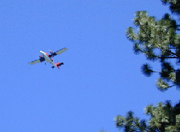
Twin Otter airplane used by the US Army Corps of Engineers for the SHOALS lidar survey of Lake Tahoe.
