Home - Images - Products - Data - Publications - Contact
Back to Maui Perspective Views
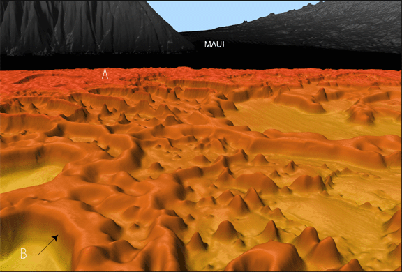
Oblique view of the seafloor looking north towards the saddle between the two volcanoes of Maui. The image shows the modern reef (A) in the background and reef pinnacles separated by basins in the forground. The reef front in the lower left corner (B) is 120 m high and the top of the bank is in 160 m water depth. The reef pinnacles interspersed with basins represents a time when relative sea level was rising and reef growth was vertical rather than horizontal to keep in the favorable growth zone. The scale across the bottom of the image is 5.6 km. The vertical exaggeration is 5x.
