Home - Images - Products - Data - Publications - Contact
Back to Maui Perspective Views
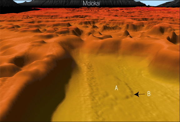
Oblique view of seafloor in northwest corner of basin shown in Figure 1, looking north. Note the small debris flow (A) on the basin floor. The toe of the debris flow (B) rises 7 m. The debris flow is 1.2 km long by 0.7 km wide. The presence of a debris flow is evidence of collapse of a section of the drowned reef wall. Drowned reef pinnacles and platforms are shown in the background. The scale at the bottom of the image is 2.5 km. The vertical exaggeration is 5x.
