Home - Images - Products - Data - Publications - Contact
Back to Maui Perspective Views
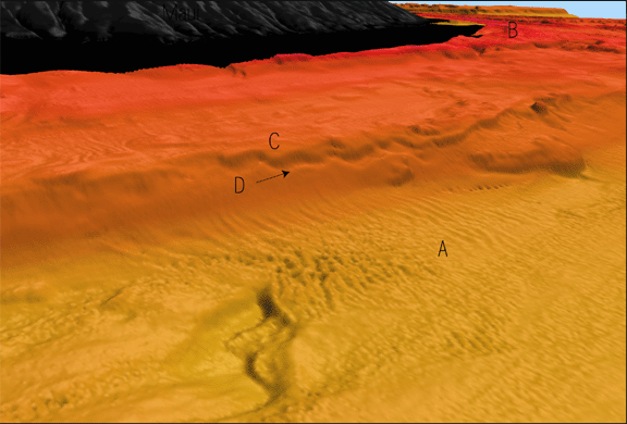
Oblique view of seafloor on west side of Maui looking east, showing a field of bedforms (A) in 220 m water depth. The bedforms occur against the base of the drowned reef platform complex, the modern reef (B), in less than 40 m. The top reef (C) is at 120 m and the second reef (D) is at 160 m water depth just west of the narrowest zone between Maui and Molokai (about 18 km). The crests of the bedforms are about 1 m high and the distance from crest to crest is about 35 m. The bedforms are caused by a strong current (estimated up to 3 kts) flowing north to south into Pailolo Channel being accelerated by the narrow pass between the two islands. The scale across the bottom of the image is 3 km. The vertical exaggeration is 5x.
