Home - Images - Products - Data - Publications - Contact
Back to Maui Perspective Views
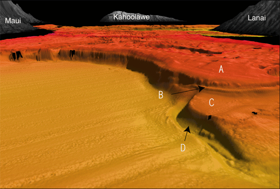
Oblique view of seafloor on the north side of Lanai, looking east. Reef platform (A) is part of the present system in water depths from 20 to 60 m; red colors in background are the living reefs in 20 m water depths. A prominent bench (B) is at 100 m depth and may represent a shoreline 20,000 years ago. Older reef platform (C) is at 160 m water depth. A 30-m deep moat has been scoured along the base of the older reef platform by strong currents flowing through Poilolo Channel between Lanai, Maui, and Molokai. The scale across the bottom of the image is 3.7 km. The vertical exaggeration is 5x.
