Home - Images - Products - Data - Publications - Contact
Back to Maui Perspective Views
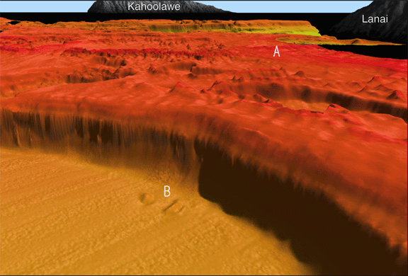
Oblique view of seafloor looking east across the modern reef platform (A) toward Kahoolawe, between Lanai and Maui. Escarpment of reef platform has 50° slopes constructed of layer-upon-layer of reef material. The slump at the base of the escarpment (B) with two large (5-m high) blocks has been transported 700 m away from the escarpment. This is one of the few occurrances of collapse of the escarpment found in this area. The scale across the bottom of the image is 2.7 km. The vertical exaggeration is 5x.
