Home - Images - Products - Data - Publications - Contact
Back to Maui Perspective Views
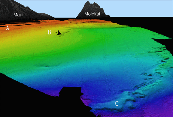
Oblique overview of the seafloor north of Maui, looking west toward Maui (upper left), Molokai (upper center) and Pailolo Channel between the two. Note the sediment cover effectively burying the drowned reef (compare with Figure 1). This north side of Maui is the windward side, capturing most of the rainfall. The south side of Maui (Figs. 1 and 2) is the leeward side with little rainfall, thus very little sediment is supplied to the seafloor. The modern reef platform (A) is shown in red and orange colors. The older drowned reef (B) is at 400 m depth. The oldest drowned reef (C) is at 550 m on the west and 625 m on the east, a tilt of less than 0.5°. The scale across the bottom of the image is 9 km. The vertical exaggeration is 5x.
