Home - Images - Products - Data - Publications - Contact
Back to Maui Perspective Views
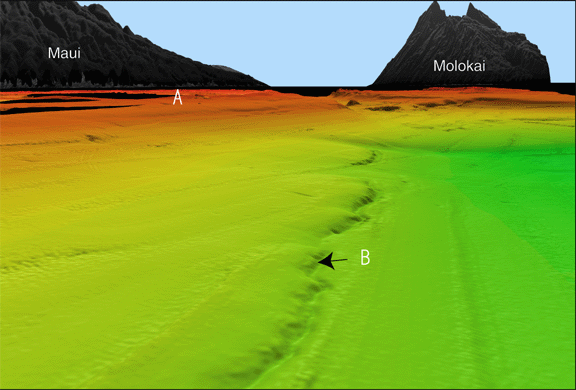
Oblique closeup view of the seafloor looking west toward Pailolo Channel, between Maui (on left) and Molokai (on right). The modern reef platform (A) is in red and orange colors. The older drowned reef (B) is at 400 m depth. The drowned reef front rises 30 m above the seafloor to the north. The scale across the bottom of the image is 7.8 km. The vertical exaggeration is 5x.
