Home - Images - Products - Data - Publications - Contact
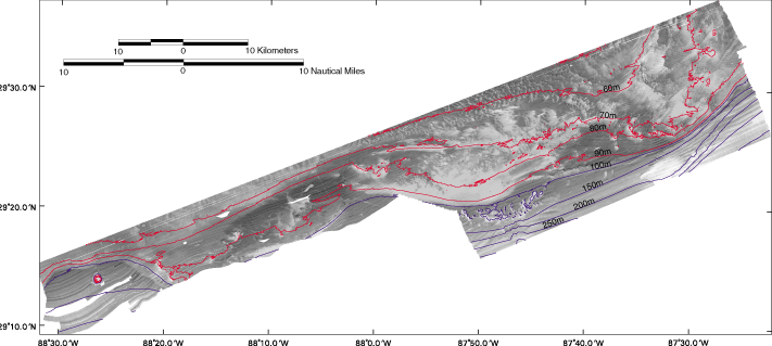
Acoustic backscatter of the Pinnacles region in Northern Gulf of Mexico (see the Pinnacles Index page for an overview of the mapped region). Brighter contrasts are stronger acoustic returns from the seafloor, whereas darker contrasts are weaker acoustic returns from the seafloor. The length of the mapped area (southwest to northeast) is approximately 115 km. The width of the mapped area (north to south) is approximately 24 km. The contour intervals are10 meter intervals from 50 to 100m (red) and 50 meter intervals from 100 to 300m (blue).
