USGS - science for a changing world

Pacific Coastal and Marine Science Center

Seafloor Mapping

Home - Images - Products - Data - Publications - Contact


Pinnacles Region of Northern Gulf of Mexico

Shaded Relief Bathymetry of Triple Top and Double Top Reef Complexes

Back to Pinnacles Perspective Views

Download a 300dpi TIFF Image (12.5mb)
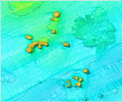
Shaded Relief bathymetry of Triple Top and Double Top Reef Complexes

Shaded Relief bathymetry of Triple Top and Double Top Reef Complexes, Pinnacles Region, Gulf of Mexico (See arrow 8 on index map for location). The isobaths are in meters below sea level, the distance across the bottom of the image is approximately 2 kilometers, and the vertical exaggeration is 5x.
 

Accessibility FOIA Privacy Policies and Notices

U.S. Department of the Interior | U.S. Geological Survey
URL: pacmaps/pn-tpmap.html
Contact Peter Dartnell
Archived in 2018