Home - Images - Products - Data - Publications - Contact
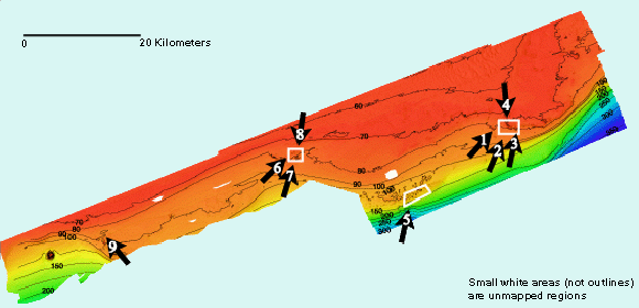
To view the oblique views, click on the arrows within the index map below, or click on the thumbnail images below the index map. See the Pinnacles home page for map location.
All images linked to below are between 106kb and 179kb in size.

Figure 1 Oblique view of Yellowtail Reef (128 kb) |
Figure 2 Oblique view of Cat's Paw Reef (111 kb) |
Figure 3 Oblique view of Roughtongue Reef (106 kb) |
Figure 4 Map view of 40 fathom reef (179 kb) |
Figure 5 Oblique view of Pinnacles Reef Complex (140 kb) |
Figure 6 Oblique view of Triple Top Reef (157 kb) |
Figure 7 Oblique view of Double Top Reef (140 kb) |
Figure 8 Map view of Triple Top - Double Top Reef Complex (174 kb) |
Figure 9 Oblique view of Alabama Alps Reef (147 kb) |