Home - Images - Products - Data - Publications - Contact
Back to the Puget Sound Perspective Views
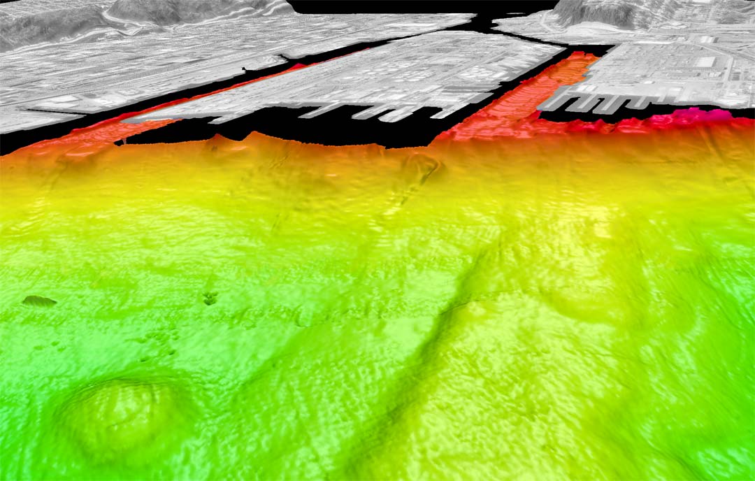
Color-coded shaded-relief bathymetry of Duwamish delta, Seattle, WA looking southeast. Colors show relative depths with reds representing shallower regions and greens representing deeper regions. The bathymetry data in this image have 4-m spatial resolution with depths ranging from 1m to 100m. The distance across the bottom of the images is 1.3km. Land is a USGS digital orthophoto quadrangle coregistered and draped over ta USGS 10-m DEM. A disposal site is in the left foreground. Notice the large failure on the left side of the right side waterway. Also notice numerous landslides along the delta front.