Home - Images - Products - Data - Publications - Contact
Back to the Puget Sound Perspective Views
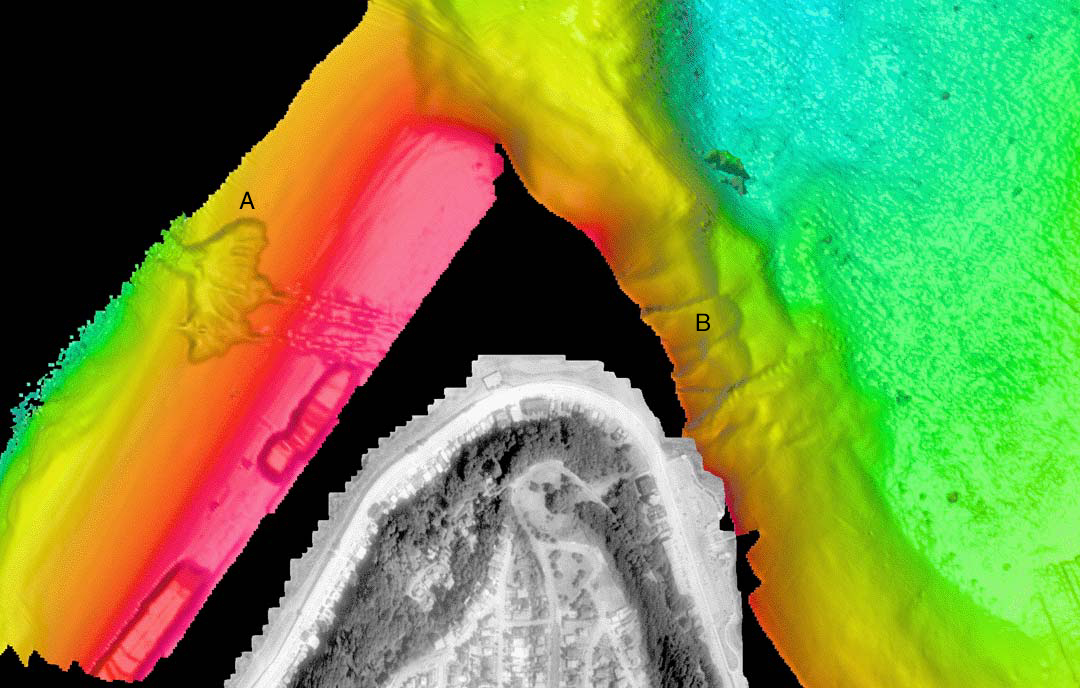
Color-coded shaded-relief bathymetry around the northern tip of Duwamish Head, Seattle, WA. Colors show relative depths with reds representing shallower regions and blues representing deeper regions. The bathymetry data in this image have 4-m spatial resolution with depths ranging from 1m to 140m. The distance across the bottom of the image is 2.2km. The land is a USGS digital orthophoto quadrangle coregistered and draped over a USGS 10-m DEM. The large failure to the west of Duwamish Head (A) occurred in 1986. The series of landslides to the east of Duwamish Head (B) are undated but appear young.