Home - Images - Products - Data - Publications - Contact
Back to the Puget Sound Perspective Views
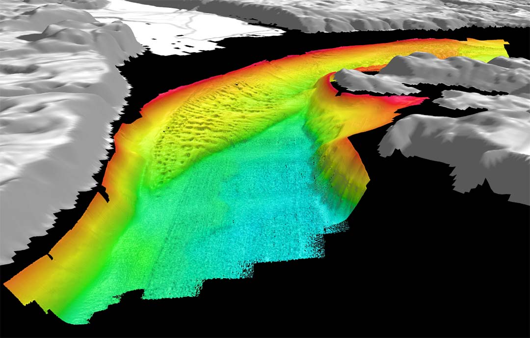
Color-coded shaded-relief bathymetry of Nisqually delta, WA looking southwest. Colors show relative depths with reds representing shallower regions and blues representing deeper regions. The bathymetry data have 3-m spatial resolution with depths ranging from 1m to 130m. The distance across the bottom of the image is about 5km. The false sun illumination is from 315°,45° elevation and the vertical exaggeration is10 x. The gray land image is generated from 10-m USGS DEMs.