Home - Images - Products - Data - Publications - Contact
Back to the Puget Sound Perspective Views
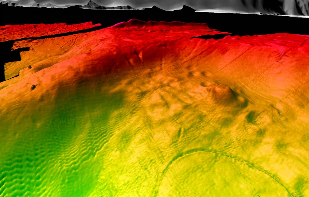
Oblique view of 1-m-resolution bathymetry along the northeast edge of Puyallup delta, WA. Colors show relative depths with reds representing shallower regions and greens representing deeper regions. Depths in this image range from 9m to about 50m. The distance across the bottom of the image is about 400m. Notice the series of expulsion pits running from lower right to upper middle of image. Expulsion features such as these are common in areas that have had severe ground shaking. Also notice the arcuate head scarp in lower right of view. This appears to be an incipient failure.