Home - Images - Products - Data - Publications - Contact
Back to the Puget Sound Perspective Views
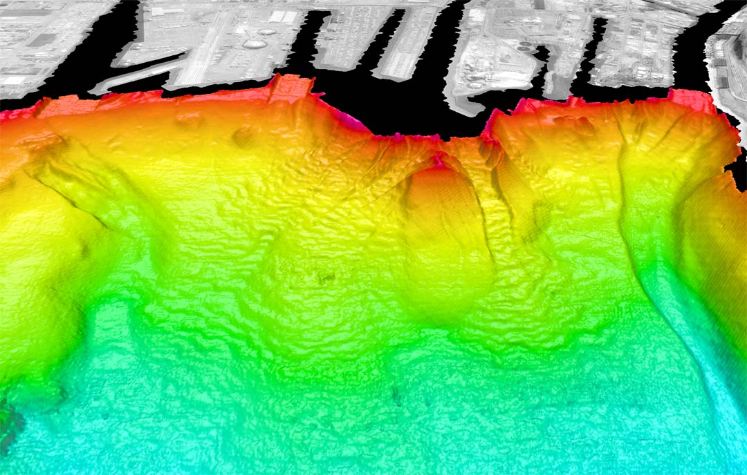
Color-coded shaded-relief of Puyallup delta, Tacoma, WA looking southeast. Colors show relative depths with reds representing shallower regions and blues representing deeper regions. The bathymetry data have 3-m spatial resolution with depths in this image ranging from 1m to about 130m. The distance across the bottom of the image is about 2.5km. The false sun illumination is from 315°, 45° elevation and the vertical exaggeration is 10 x. The land is a USGS digital orthophoto quadrangle coregistered and draped over a USGS 10-m DEM. The large deposit in the middle of the view is a disposal site abandoned in the mid 1980s and has since been split by a slump. The large landslide scar on the right side of image was caused by an 1894 landslide. Notice other landslides along the delta front.