Home - Images - Products - Data - Publications - Contact
Return to San Pedro Bay Perspective Views
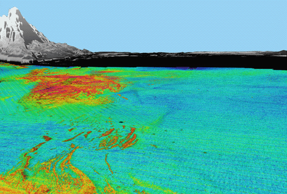
Figure 1. Perspective view of continental shelf south of San Pedro Bay looking north. Seafloor image is backscatter draped over bathymetry; reds and oranges are high backscatter, blues and greens are low backscatter. Gray area is land, black area is unmapped. Areas of high backscatter are rock outcrops that rise less than 5 m above the surrounding seafloor. The distance across the bottom of image is 4 km; water depths range from 19 m to 50 m. Vertical exaggeration 10x.
