Home - Images - Products - Data - Publications - Contact
Return to San Pedro Bay Perspective Views
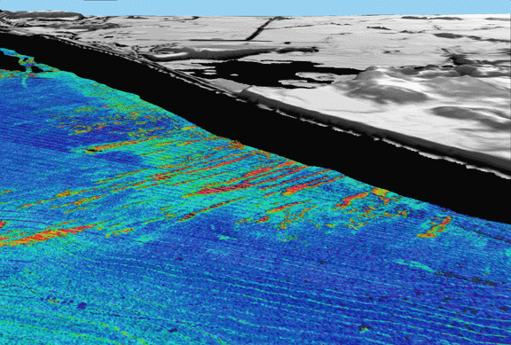
Figure 2. Perspective view of continental shelf adjacent to Huntington Beach, CA looking north. Seafloor image is backscatter draped over bathymetry; reds and oranges are high backscatter, blues and greens are low backscatter. Gray area is land, black area is unmapped. Linear high-backscatter seafloor features perpendicular to coastline are depressions ~20-m wide,and ~0.5-m deep. Distance across bottom of image is 2.7 km, water depth range from 25 m to 70 m deep. Vertical exaggeration 10x.
