Home - Images - Products - Data - Publications - Contact
Return to San Pedro Bay Perspective Views
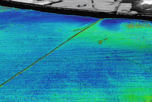
Figure 3. Perspective view of continental shelf adjacent to area between Huntington Beach and Newport Beach, CA looking north. Seafloor image is backscatter draped over bathymetry; reds and oranges are high backscatter, blues and greens are low backscatter. Gray area is land, black area is unmapped. The two linear features are Orange County Sanitation District ocean outfall pipes. Notice zone of high backscatter (green) around an south of outfall pipe. High-backscatter linear features perpendicular to coast are depressions ~20-m wide,and ~0.5-m deep. (similar to those shown in Fig. 2). Distance across bottom of image 2.4 km, portion of long pipe shown is 5.1 km long. Vertical exaggeration 10x.
