Home - Images - Products - Data - Publications - Contact
Return to San Pedro Bay Perspective Views
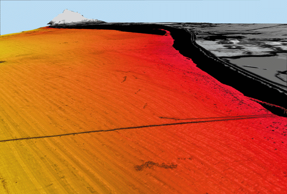
Figure 4a. Perspective view of color-coded bathymetry of the continental shelf adjacent to area between Huntington Beach and Newport Beach, CA looking northwest. Water depths vary from 10 m (red) to 60 m (light orange). Gray area is land, black area is unmapped. The two linear features are Orange County Sanitation District ocean outfall pipes.
