Home - Images - Products - Data - Publications - Contact
Return to San Pedro Bay Perspective Views

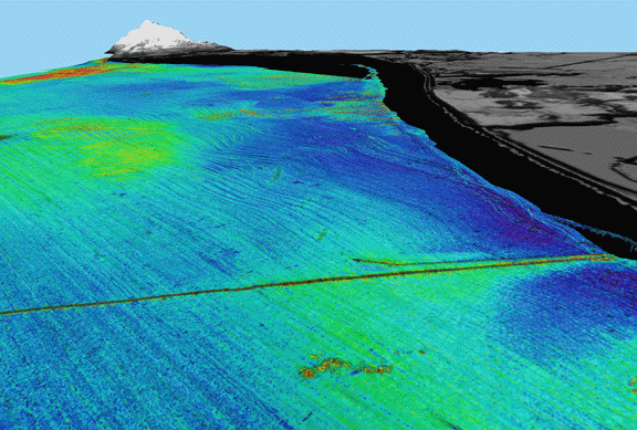
Figure 4b. Same Perspective view of continental shelf as in Figure 4a but in this view the seafloor image is backscatter draped over bathymetry; reds and oranges are high backscatter, blues and greens are low backscatter. Notice zone of high backscatter (green) around an south of outfall pipe. Distance across bottom of image 2.3 km. Vertical exaggeration 5x.