Home - Images - Products - Data - Publications - Contact
Return to San Pedro Bay Perspective Views
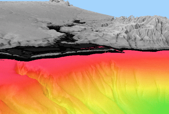
Figure 6. Perspective view of the seafloor off Newport Bay, CA, looking north. Vertical exaggeration is 5x. Red colors show depth ranges from 5m to approximately 120m on the continental shelf. Yellows and light greens show depth ranges from approximately 120m to 370m on the continental slope. Black areas are too shallow to map with the multibeam system. Grey shades show land elevations ranging from 0m to 300m. The distance across the bottom of the image is 6.3km. The image shows that the narrow continental shelf immediately south of the Newport Bay broadens to the northwest. Only one deep channel of the several major canyons of the Newport Canyon system incises the shelf, and extends almost to the beach. This incised canyon is 150m wide and 8m deep directly offshore Newport Bay.
