Pacific Coastal and Marine Science Center

|
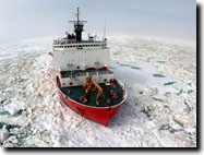
2009 Extended Continental Shelf (ECS) ProjectUSGS and Canadian Scientists Conduct a Second Cruise to Map the Arctic Sea FloorU.S. and Canadian scientists conducted a joint 42-day Arctic mission in the summer of 2009 to collect scientific data about the extended continental shelf and Arctic seafloor. The mission, from August 6 to September 16, 2009, continued the collaboration in extended continental shelf data collection in the Arctic started during the 2008 joint survey, with plans for further cooperation in 2010. The interagency and intergovernmental effort featured U.S. Coast Guard Cutter Healy and Canadian Coast Guard Ship Louis S. St-Laurent. The 2009 Continental Shelf Survey emphasized the region north of Alaska onto Alpha-Mendeleev Ridge and eastwards toward the Canada Archipelago. The mission helped define the extended continental shelf (beyond 200 miles from shore) in the Arctic Ocean, as well as U.S. and Canadian sovereign rights based on criteria set forth in the UN Convention on the Law of the Sea. More information:
|