Other ID: none
Status: Completed
Organization(s): USGS, St. Petersburg Coastal and Marine Science Center
Funding Program(s):
Principal Investigator(s): James Flocks
Affiliate Investigator(s):
Information Specialist(s): Arnell Forde, Dana Wiese
Data Type(s): Other: Unknown, Electro-Magnetic: Resistivity, Imagery: Photo, Location-Elevation: Benchmarks, Location-Elevation: Navigation, Location-Elevation: Profiles, Location-Elevation: Transects, Seismics: Sub Bottom Profiler, Sonar: Multibeam, Sonar: Sidescan, Sonar: Sound Velocity
Scientific Purpose/Goals: To create a complete modern topobathymetric map of the Mississippi barrier islands from Cat Island to Dauphin Island. Data to provide information for the following: sediment budget; assessment of immediate sand resources in the region, modern geologic framework; historical island change measurements; base-level assessment of the seafloor since the 2005 hurricane season
Vehicle(s):
Start Port/Location: Biloxi, Mississippi
End Port/Location: Biloxi, Mississippi
Start Date: 2010-03-19
End Date: 2010-03-29
Equipment Used: Interferometric Bathymetry System, Ashtech Z-Xtreme DGPS, Chirp 512i, Klein Side Scan Sonar, Valeport SVP, Camera, Digital, Hand Held, F190 DGPS/IMU
Information to be Derived: Submetrix swath bathymetry data; shallow sub-botom image profiles and, side-scan sonar mosaics
Summary of Activity and Data Gathered: A total of 192 chirp 2-D sub-bottom profiles, 192 swath, and 102 side scan lines were collected.
Staff: Nancy DeWitt, James Flocks, Kyle Kelso, William Pfeiffer, Philip Thompson, Dana Wiese
Affiliate Staff:
Notes: Shop Staff (Pre-Cruise) - Dave Wegener contributed 1.5 weeks to design and fabrication; Richard Young was boat captain during 2 days of Side Scan equipment testing. Additional equipment: L3900 Klein Side Scan Towfish.
Location:
Horn Island, MS to Dauphin Island, AL
| Boundaries | |||
|---|---|---|---|
| North: 30.55457433 | South: 29.7939254 | West: -89.6141 | East: -87.47169814 |
Platform(s):
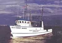 Tommy Munro |
Flocks, J., Forde, A., 2025, Shallow Geologic Framework of the Mississippi Sound and the Potential for Sediment Resources: U.S. Geological Survey Scientific Investigations Report (2025-5100), https://doi.org/10.3133/sir20255100.
Flocks, J.G., Kindinger, J., Kelso, K.W., Bernier, J.C., DeWitt, N.T., FitzHarris, M., 2015, Near-surface stratigraphy and morphology, Mississippi Inner Shelf, northern Gulf of Mexico: U.S. Geological Survey Open-File Report 2015-1014, 26 p., https://doi.org/10.3133/ofr20151014.
Flocks, J.G., Kindinger, J.L., Kelso, K.W., 2015, Geologic control on the evolution of the inner shelf morphology offshore of the Mississippi barrier islands, northern Gulf of Mexico, USA: Continental Shelf Research, v. 101, pp. 59–70, doi: 10.1016/j.csr.2015.04.008.
Forde, A.S., Dadisman, S.V., Flocks, J.G., Wiese, D.S., DeWitt, N.T., Pfeiffer, W.R., Kelso, K.W., Thompson, P.R., 2011, Archive of digital CHIRP sub-bottom profile data collected during USGS cruises 10CCT01, 10CCT02, and 10CCT03, Mississippi and Alabama Gulf Islands, March and April 2010: U.S. Geological Survey Data Series 611, https://doi.org/10.3133/ds611.
Gal, N.S., Wallace, D.J., Miner, M.D., Hollis, R.J., Dike, C., Flocks, J.G., 2021, Influence of antecedent geology on the Holocene formation and evolution of Horn Island, Mississippi, USA: Marine Geology, v. 431, 106375 p., doi: 10.1016/j.margeo.2020.106375.
Pendleton, E.A., Baldwin, W.E., Danforth, W.W., DeWitt, N.T., Foster, D.S., Forde, A.S., Kelso, K.W., Pfeiffer, W.R., Turecek, A., Flocks, J.G., Twichell, D.C., 2011, Geophysical data from offshore of the Gulf Islands National Seashore, Cat Island to western Horn Island, Mississippi: U.S. Geological Survey Open-File Report 2010-1178, https://doi.org/10.3133/ofr20101178.
Pfeiffer, W.R., Flocks, J.G., DeWitt, N.T., Forde, A.S., Kelso, K., Thompson, P.R., Wiese, D.S., 2011, Archive of sidescan sonar and swath bathymetry data collected during USGS cruise 10CCT02 offshore from Petit Bois Island including Petit Bois Pass, Gulf Islands National Seashore, Mississippi, March 2010: U.S. Geological Survey Data Series 577, https://doi.org/10.3133/ds577.
Twichell, D.C., Pendleton, E.A., Flocks, J.G., Baldwin, W.E., Foster, D.S., 2011, The shallow stratigraphy and sand resources offshore of the western part of the Mississippi barrier islands: U.S. Geological Survey Open-File Report 2011-1173, https://doi.org/10.3133/ofr20111173.
Twichell, D.C., Pendleton, E.A., Flocks, J.G., Baldwin, W.E., and Foster, D.S., 2011, The shallow stratigraphy and sand resources offshore of the Mississippi Barrier Islands: U.S. Geological Survey Open-File Report 2011-1173, https://doi.org/10.3133/ofr20111173.
FAN 10CCT02 has data viewable in the GeoMappApp/Virtual Ocean applications. To view this data in these applications go to http://www.geomapapp.org/ and http://www.virtualocean.org/. See the instructions for locating USGS data in these applications. You can also view the imagery created from the SEGY data at https://cmgds.marine.usgs.gov/images.php?cruise=10CCT02.
| Survey Equipment | Survey Info | Data Type(s) | Data Collected |
|---|---|---|---|
| Interferometric Bathymetry System | --- | Interferometric | DS 577 ArcGIS_Project (Data Series 577 GIS dataset) 10cct02_sw_v2_50m (Interferometric swath bathy grid as GeoTiff, 50-m resolution) Sample10cct02_1m (Composite ASCII file of sidescan sonar mosaic pixel values and bathymetric depth) 10cct02_bathy_cover (Interferometric swath bathymetric grid in PDF layout) 10cct02_swss_overlay (Sidescan sonar backscatter and interferometric swath bathymetry composite grid as PDF layout) |
| Ashtech Z-Xtreme DGPS | --- | Benchmarks Navigation | 10CCT02-NL-pd-1 (HYPACK navigation tracklines in shapefile format) 10CCT02-NL-pd-2 (HYPACK navigation tracklines in PDF layout) 10CCT02-NL-pd-3 (Interferometric swath bathymetry tracklines in PDF layout) 10CCT02-NL-pd-4 (Sidescan sonar tracklines in PDF layout) |
| Chirp 512i | --- | Sub Bottom Profiler | 10CCT02-SE-pd-3 (Chirp 512i data GIS) 10CCT02-SE-pd-5 (Chirp 512i data agc SEGY) 10CCT02-SE-pd-1 (Chirp 512i data navigation) 10CCT02-SE-pd-2 (Chirp 512i data profiles) 10CCT02-SE-pd-4 (Chirp 512i data GeoMapApp) |
| Klein Side Scan Sonar | --- | Sidescan | 10CCT02-BS-pd-2 (Sidescan sonar mosaic as PDF layout) 10CCT02-BS-pd-1 (Sidescan sonar mosaic as Geotiff) |
| Valeport SVP | --- | Sound Velocity | |
| Camera, Digital, Hand Held | --- | Photo | |
| F190 DGPS/IMU | --- | Navigation | No data was collected |
