Other ID: none
Status: Completed
Organization(s): USGS, St. Petersburg Coastal and Marine Science Center
Funding Program(s): Barrier Island Evolution Research - BIER Sedimentology (GX.17.MN00.F1F50.00)
Principal Investigator(s): Jennifer Miselis
Affiliate Investigator(s):
Information Specialist(s): Dana Wiese
Data Type(s): Location-Elevation: Benchmarks, Location-Elevation: Navigation, Location-Elevation: Profiles, Location-Elevation: Transects, Seismics: Sub Bottom Profiler, Sonar: Interferometric, Sonar: Multibeam, Sonar: Sidescan, Sonar: Sound Velocity
Scientific Purpose/Goals: Barrier Island Mapping Change
Vehicle(s): Ford F-350 Dually White (GSA)
Start Port/Location: Biloxi, MS
End Port/Location: Biloxi, MS
Start Date: 2012-07-20
End Date: 2012-08-04
Equipment Used: F190 DGPS/IMU, Chirp 424, Sidescan Sonar, Valeport SVP, Interferometric Bathymetry System, Ashtech Z-Xtreme DGPS, Geodometer 640 Total Station, GPS , Klein Side Scan
Information to be Derived: Barrier Island Mapping Change
Summary of Activity and Data Gathered: Swath Bathymetry, side scan imagery, and chirp sub-bottom profiles
Staff: Julie Bernier, Nancy DeWitt, Keith Ludwig, William Pfeiffer, Philip Thompson, Lance Thornton, Dana Wiese
Affiliate Staff:
Notes: Shop Time: R. Hall, P. Thompson, K. Ludwig and L. Thornton all contributed with preparations by providing assistance for vessels, mounts and testing prior to departure.
Location:
Chandeleur Islands, LA (Berm area)
| Boundaries | |||
|---|---|---|---|
| North: 30.22710095 | South: 29.27292108 | West: -89.2076 | East: -88.20778246 |
Platform(s):
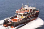
Pilatus PC6 |  Survey Cat (Class 3) |
DeWitt, N.T., Bernier, J.C., Pfeiffer, W.R., Miselis, J.L., Reynolds, B.J., Wiese, D.S., Kelso, K.W., 2014, Coastal bathymetry and backscatter data collected in 2012 from the Chandeleur Islands, Louisiana: U.S. Geological Survey Data Series 847, https://doi.org/10.3133/ds847.
Forde, A.S., Miselis, J.L., Wiese, D.S., 2014, Archive of digital chirp subbottom profile data collected during USGS cruise 12BIM03 offshore of the Chandeleur Islands, Louisiana, July 2012: U.S. Geological Survey Data Series 856, https://doi.org/10.3133/ds856.
Mickey, R.C., Long, J.W., Plant, N.G., Thompson, D.M., Dalyander, P.S., 2017, A methodology for modeling barrier island storm-impact scenarios: U.S. Geological Survey Open-File Report 2017-1009, https://doi.org/10.3133/ofr20171009.
Plant, N.G., Flocks, J., Stockdon, H.F., Long, J.W., Guy, K.K., Thompson, D.M., Cormier, J.M., Smith, C.G., Miselis, J.L., Dalyander, P.S., 2014, Predictions of barrier island berm evolution in a time-varying storm climatology: Journal of Geophysical Research F: Earth Surface, v. 119 no. 2, pp. 300–316, doi: 10.1002/2013jf002871.
FAN 12BIM03 has data viewable in the GeoMappApp/Virtual Ocean applications. To view this data in these applications go to http://www.geomapapp.org/ and http://www.virtualocean.org/. See the instructions for locating USGS data in these applications. You can also view the imagery created from the SEGY data at https://cmgds.marine.usgs.gov/images.php?cruise=12BIM03.
| Survey Equipment | Survey Info | Data Type(s) | Data Collected |
|---|---|---|---|
| F190 DGPS/IMU | --- | Navigation | |
| Chirp 424 | --- | Sub Bottom Profiler | Data series 856 profiles (Chirp 424 data profiles) Data series 856 arc (Chirp 424 data GIS) Data series 856 nav (Chirp 424 data navigation) Data series 856 segy (Chirp 424 data agc SEGY) |
| Sidescan Sonar | --- | Sidescan | |
| Valeport SVP | --- | Sound Velocity | |
| Interferometric Bathymetry System | --- | Interferometric | 12BIM03_IFB_ITRF05_xyz (2012 ASCII Point Files from Interferometric Bathymetry: ITRF05) 12BIM03_IFB_NAD83_NAVD88_MLLW_xyz (2012 ASCII Point Files from Interferometric Bathymetry: NAD83_MLLW) 12BIM03_IFB_NAD83_NAVD88_GEOID09_xyz (2012 ASCII Point Files from Interferometric Bathymetry: NAD83_NVD88_GEOID09) Chandeleurs_2012_50_NAD83_NAVD88_GEOID09_DEM (bathymetric (single-beam and swath) grid in Geotiff format, 50-m resolution) Data series 847 GIS (Includes tracklines (swath (IFB), single-beam (SBB)), Base station locations, USGS Lidar extent, Backscatter mosaic, and bathymetric (swath and single-beam) grid.) 12BIM03_IFB_Mosaic (Interferometric Swath Backscatter mosaic, 1-m resolution as Geotiff) |
| Ashtech Z-Xtreme DGPS | --- | Benchmarks Navigation | 12BIM03-BA-pd-6 (Swath navigation tracklines) Processed 1,000-Shot-Interval Location Navigation Processed Shotpoint Navigation |
| Geodometer 640 Total Station | --- | Navigation | |
| GPS | --- | Navigation | |
| Klein Side Scan | --- | Sidescan |