AKA: none
Other ID: H-3-05-AR,HLY0503
Status: Completed
Organization(s): USGS, Pacific Coastal and Marine Science Center
Funding Program(s): Arctic Ocean Polar Studies (MU013)
Principal Investigator(s):
Affiliate Investigator(s): Bernard Coakley, Univ. of Alaska, Fairbanks AK; Yngve Kristoffersen, Univ. of Bergen, Bergen, Norway: John Hopper, Texas A&M, College Station TX.
Information Specialist(s): Patrick Hart, Jonathan Childs
Data Type(s): Electro-Magnetic: Gravity, Location-Elevation: Navigation, Seismics: Multichannel, Seismics: Sonobuoy, Seismics: Sub Bottom Profiler, Sonar: Multibeam
Scientific Purpose/Goals: Deciphering the Tectonic History, Structure and Stratigraphy of the Arctic Basin and Plate Boundries
Vehicle(s):
Start Port/Location: Dutch Harbor, Alaska
End Port/Location: Tromso, Norway
Start Date: 2005-08-05
End Date: 2005-09-30
Equipment Used: Sonobuoy, gravity, navigation, 2channelairgun, 512 chirp
Information to be Derived: Deciphering the Tectonic History, Structure and Stratigraphy of the Arctic Basin and Plate Boundries
Summary of Activity and Data Gathered: 47 lines of seismic reflection data, 97 sonobuoy seismic refraction data gravity anomaly data, swath bathymetry, sub-bottom profiles
Staff:
Affiliate Staff:
Notes: Equipment details:
16 to 24 channel streamer, 200 to 300 meters length;
Airgun seismic reflection and sonobuoy refraction;
Multibeam swath bathymetry (Seabeam model 2112);
Gravimeter (Bell BGM-3);
Chirp sub-bottom profiler.
Co-Chief Scientists:
Bernard Coakley, Univ. of Alaska, Fairbanks AK;
Yngve Kristoffersen, Univ. of Bergen, Bergen, Norway:
John Hopper, Texas A&M, College Station TX.
Location:
Arctic Ocean
| Boundaries | |||
|---|---|---|---|
| North: 84.35754105 | South: 55.54722014 | West: -70.1367 | East: -12.40234375 |
Platform(s):
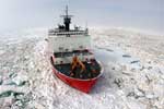 Healy |
Dove, D.W., 2007, STRATIGRAPHY, STRUCTURE, AND ORIGIN OF THE MENDELEEV RIDGE FROM BATHYMETRY, CONTROLLED SOURCE SEISMIC, AND GRAVITY OBSERVATIONS: A thesis presented to the Faculty of the University of Alaska Fairbanks, https://walrus.wr.usgs.gov/infobank/h/h305ar/meta/Dove_MS_Thesis_UAF_reduced.pdf.
FAN H305AR has data viewable in the GeoMappApp/Virtual Ocean applications. To view this data in these applications go to http://www.geomapapp.org/ and http://www.virtualocean.org/. See the instructions for locating USGS data in these applications. You can also view the imagery created from the SEGY data at https://cmgds.marine.usgs.gov/images.php?cruise=H305AR.
| Survey Equipment | Survey Info | Data Type(s) | Data Collected |
|---|---|---|---|
| Sonobuoy | --- | Sonobuoy | |
| gravity | --- | Gravity | |
| navigation | --- | Navigation | Global positioning system (GPS) data h-3-05-ar.060 (Provisional best file) Best file with nav in ArcInfo E00 format |
| 2channelairgun | --- | Multichannel | |
| 512 chirp | --- | Sub Bottom Profiler |
